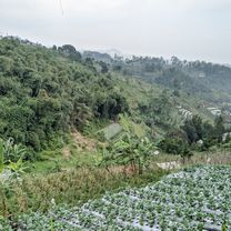
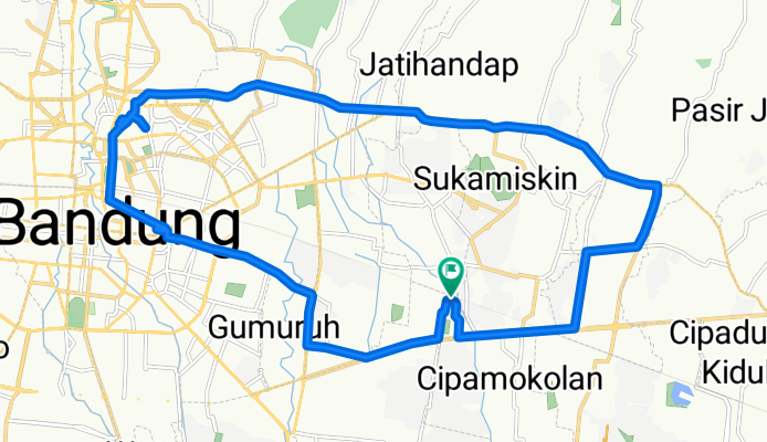
Jando Road Bike
A cycling route starting in Bandung, West Java, Indonesia.
Overview
About this route
- 5 h 47 min
- Duration
- 28.9 km
- Distance
- 122 m
- Ascent
- 120 m
- Descent
- 5 km/h
- Avg. speed
- 744 m
- Max. altitude
Route photos
Continue with Bikemap
Use, edit, or download this cycling route
You would like to ride Jando Road Bike or customize it for your own trip? Here is what you can do with this Bikemap route:
Free features
- Save this route as favorite or in collections
- Copy & plan your own version of this route
- Sync your route with Garmin or Wahoo
Premium features
Free trial for 3 days, or one-time payment. More about Bikemap Premium.
- Navigate this route on iOS & Android
- Export a GPX / KML file of this route
- Create your custom printout (try it for free)
- Download this route for offline navigation
Discover more Premium features.
Get Bikemap PremiumFrom our community
Other popular routes starting in Bandung
Bike Story- Distance
- 32.6 km
- Ascent
- 178 m
- Descent
- 179 m
- Location
- Bandung, West Java, Indonesia
all arounderer- Distance
- 136.4 km
- Ascent
- 780 m
- Descent
- 776 m
- Location
- Bandung, West Java, Indonesia
Dago Mountain View - Bojongkoneng- Distance
- 34.5 km
- Ascent
- 640 m
- Descent
- 642 m
- Location
- Bandung, West Java, Indonesia
GGB Bintang#2 - Caringin Tilu-Lembur Lebak- Distance
- 17.8 km
- Ascent
- 676 m
- Descent
- 679 m
- Location
- Bandung, West Java, Indonesia
Jumat ceria- Distance
- 33.3 km
- Ascent
- 1,227 m
- Descent
- 636 m
- Location
- Bandung, West Java, Indonesia
dago pakar to cikapundung- Distance
- 5.4 km
- Ascent
- 27 m
- Descent
- 224 m
- Location
- Bandung, West Java, Indonesia
dataran tinggi- Distance
- 44.3 km
- Ascent
- 1,264 m
- Descent
- 1,284 m
- Location
- Bandung, West Java, Indonesia
TOL Tanjungsari - Situraja- Distance
- 62.9 km
- Ascent
- 6,160 m
- Descent
- 6,160 m
- Location
- Bandung, West Java, Indonesia
Open it in the app


