
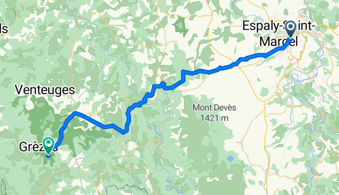
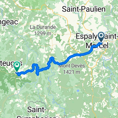
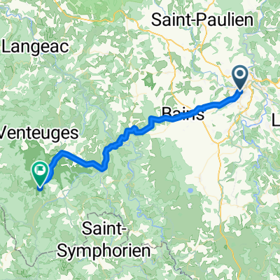
J1-Craponne-LePuy
A cycling route starting in Le Puy-en-Velay, Auvergne-Rhône-Alpes, France.
Overview
About this route
- 3 h 2 min
- Duration
- 46.2 km
- Distance
- 1,781 m
- Ascent
- 1,319 m
- Descent
- 15.2 km/h
- Avg. speed
- 1,250 m
- Max. altitude
Route quality
Waytypes & surfaces along the route
Waytypes
Track
21.2 km
(46 %)
Quiet road
13.8 km
(30 %)
Surfaces
Paved
11.5 km
(25 %)
Unpaved
13.8 km
(30 %)
Gravel
12 km
(26 %)
Asphalt
11.5 km
(25 %)
Continue with Bikemap
Use, edit, or download this cycling route
You would like to ride J1-Craponne-LePuy or customize it for your own trip? Here is what you can do with this Bikemap route:
Free features
- Save this route as favorite or in collections
- Copy & plan your own version of this route
- Sync your route with Garmin or Wahoo
Premium features
Free trial for 3 days, or one-time payment. More about Bikemap Premium.
- Navigate this route on iOS & Android
- Export a GPX / KML file of this route
- Create your custom printout (try it for free)
- Download this route for offline navigation
Discover more Premium features.
Get Bikemap PremiumFrom our community
Other popular routes starting in Le Puy-en-Velay
 Le Puy en Velay - Saint Jean Pied de Port
- Distance
- 715.6 km
- Ascent
- 2,295 m
- Descent
- 2,772 m
- Location
- Le Puy-en-Velay, Auvergne-Rhône-Alpes, France
 Le Puy en Velay / Saint Vincent
- Distance
- 35.9 km
- Ascent
- 220 m
- Descent
- 224 m
- Location
- Le Puy-en-Velay, Auvergne-Rhône-Alpes, France
 Day 1 - Way of St. James - Le Puy to SJPP
- Distance
- 42.9 km
- Ascent
- 972 m
- Descent
- 643 m
- Location
- Le Puy-en-Velay, Auvergne-Rhône-Alpes, France
 voie verte coubon
- Distance
- 18.1 km
- Ascent
- 155 m
- Descent
- 149 m
- Location
- Le Puy-en-Velay, Auvergne-Rhône-Alpes, France
 Tour 2010 (3)
- Distance
- 121.7 km
- Ascent
- 1,856 m
- Descent
- 1,600 m
- Location
- Le Puy-en-Velay, Auvergne-Rhône-Alpes, France
 Le-Puy-en-Velay -> Thiers
- Distance
- 129.3 km
- Ascent
- 1,257 m
- Descent
- 1,497 m
- Location
- Le Puy-en-Velay, Auvergne-Rhône-Alpes, France
 J1-Craponne-LePuy
- Distance
- 46.2 km
- Ascent
- 1,781 m
- Descent
- 1,319 m
- Location
- Le Puy-en-Velay, Auvergne-Rhône-Alpes, France
 Jakobsweg Etappe 7 - Via Podensis : Le Puy - Decazeville
- Distance
- 226 km
- Ascent
- 2,507 m
- Descent
- 2,943 m
- Location
- Le Puy-en-Velay, Auvergne-Rhône-Alpes, France
Open it in the app