
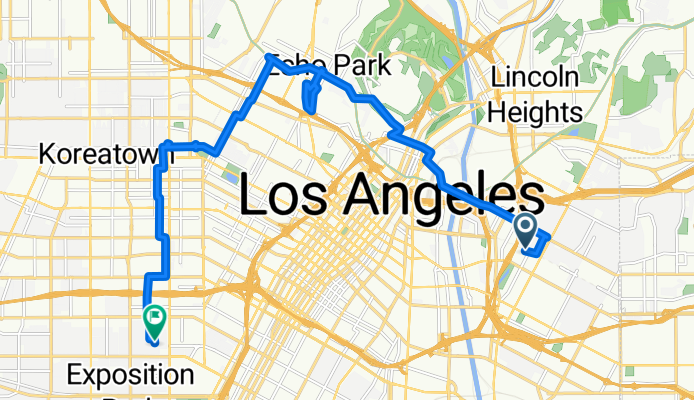
North Cummings Street to Walton Avenue
A cycling route starting in Boyle Heights, California, United States.
Overview
About this route
- 1 h 56 min
- Duration
- 20.1 km
- Distance
- 210 m
- Ascent
- 213 m
- Descent
- 10.4 km/h
- Avg. speed
- 152 m
- Max. altitude

Route photos


Route quality
Waytypes & surfaces along the route
Waytypes
Quiet road
6.6 km
(33 %)
Road
4.2 km
(21 %)
Surfaces
Paved
8.2 km
(41 %)
Asphalt
6 km
(30 %)
Concrete
1.6 km
(8 %)
Continue with Bikemap
Use, edit, or download this cycling route
You would like to ride North Cummings Street to Walton Avenue or customize it for your own trip? Here is what you can do with this Bikemap route:
Free features
- Save this route as favorite or in collections
- Copy & plan your own version of this route
- Sync your route with Garmin or Wahoo
Premium features
Free trial for 3 days, or one-time payment. More about Bikemap Premium.
- Navigate this route on iOS & Android
- Export a GPX / KML file of this route
- Create your custom printout (try it for free)
- Download this route for offline navigation
Discover more Premium features.
Get Bikemap PremiumFrom our community
Other popular routes starting in Boyle Heights
 Boyle Heights-DTLA
- Distance
- 14.7 km
- Ascent
- 140 m
- Descent
- 143 m
- Location
- Boyle Heights, California, United States
 ZDA (west - east)
- Distance
- 5,351.4 km
- Ascent
- 7,239 m
- Descent
- 7,310 m
- Location
- Boyle Heights, California, United States
 Fucked Up In Boyle Heights
- Distance
- 17.8 km
- Ascent
- 94 m
- Descent
- 100 m
- Location
- Boyle Heights, California, United States
 Mariachi-CityHall-LALivemural
- Distance
- 12.6 km
- Ascent
- 133 m
- Descent
- 137 m
- Location
- Boyle Heights, California, United States
 Route
Route- Distance
- 104.2 km
- Ascent
- 303 m
- Descent
- 300 m
- Location
- Boyle Heights, California, United States
 Sunrise Elementary School
- Distance
- 16.5 km
- Ascent
- 135 m
- Descent
- 126 m
- Location
- Boyle Heights, California, United States
 East Cesar E Chavez Avenue 2630, Los Angeles to Atlantic Blvd/Avenida Cesar Chavez, Monterey Park
- Distance
- 6.2 km
- Ascent
- 0 m
- Descent
- 0 m
- Location
- Boyle Heights, California, United States
 ZDA (west - east)
- Distance
- 5,351.4 km
- Ascent
- 7,525 m
- Descent
- 7,596 m
- Location
- Boyle Heights, California, United States
Open it in the app