
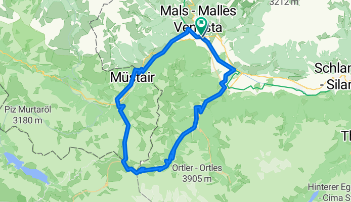
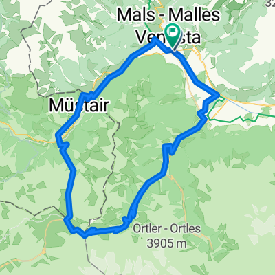
Silbergasse nach Silbergasse
A cycling route starting in Glurns, Trentino-Alto Adige, Italy.
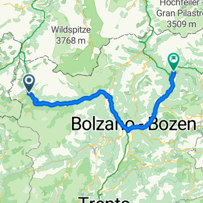
Overview
About this route
- 5 h 11 min
- Duration
- 68 km
- Distance
- 2,693 m
- Ascent
- 2,692 m
- Descent
- 13.1 km/h
- Avg. speed
- 2,762 m
- Max. altitude
Route quality
Waytypes & surfaces along the route
Waytypes
Track
12.2 km
(18 %)
Cycleway
9.5 km
(14 %)
Surfaces
Paved
53.1 km
(78 %)
Unpaved
8.2 km
(12 %)
Asphalt
49.7 km
(73 %)
Gravel
6.1 km
(9 %)
Continue with Bikemap
Use, edit, or download this cycling route
You would like to ride Silbergasse nach Silbergasse or customize it for your own trip? Here is what you can do with this Bikemap route:
Free features
- Save this route as favorite or in collections
- Copy & plan your own version of this route
- Sync your route with Garmin or Wahoo
Premium features
Free trial for 3 days, or one-time payment. More about Bikemap Premium.
- Navigate this route on iOS & Android
- Export a GPX / KML file of this route
- Create your custom printout (try it for free)
- Download this route for offline navigation
Discover more Premium features.
Get Bikemap PremiumFrom our community
Other popular routes starting in Glurns
 PASS DAL FUORN/ OFENPASS (por Glurns/ Glorenza)
- Distance
- 28.6 km
- Ascent
- 1,396 m
- Descent
- 156 m
- Location
- Glurns, Trentino-Alto Adige, Italy
 20140617_095125.gpx
- Distance
- 61.1 km
- Ascent
- 50 m
- Descent
- 659 m
- Location
- Glurns, Trentino-Alto Adige, Italy
 🚴♀️E*Bike🇮🇩+🇨🇭 Glurns-STILFSER-JOCH-Glurns
- Distance
- 66 km
- Ascent
- 1,844 m
- Descent
- 1,841 m
- Location
- Glurns, Trentino-Alto Adige, Italy
 Silbergasse nach Silbergasse
- Distance
- 68 km
- Ascent
- 2,693 m
- Descent
- 2,692 m
- Location
- Glurns, Trentino-Alto Adige, Italy
 Wiesenweg nach Glurns
- Distance
- 12.5 km
- Ascent
- 1,244 m
- Descent
- 172 m
- Location
- Glurns, Trentino-Alto Adige, Italy
 OrtlerRunde
- Distance
- 314.8 km
- Ascent
- 9,655 m
- Descent
- 9,655 m
- Location
- Glurns, Trentino-Alto Adige, Italy
 7 - Von Mals bis Bozen
- Distance
- 142.7 km
- Ascent
- 1,561 m
- Descent
- 1,667 m
- Location
- Glurns, Trentino-Alto Adige, Italy
 Stelvio - Gavia
- Distance
- 96.1 km
- Ascent
- 3,200 m
- Descent
- 2,862 m
- Location
- Glurns, Trentino-Alto Adige, Italy
Open it in the app