- 54.1 km
- 717 m
- 762 m
- Peyrat-le-Château, Nouvelle-Aquitaine, France
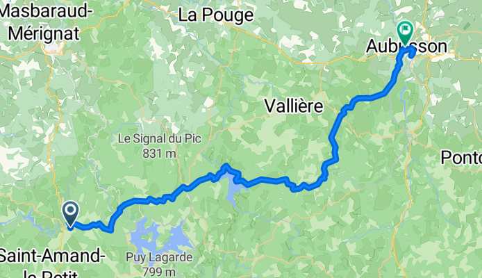
Peyrat-le-Château to Aubusson - V87 part of way
A cycling route starting in Peyrat-le-Château, Nouvelle-Aquitaine, France.
Overview
About this route
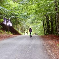
This was a great route with plenty of ups and downs, though none were killer hills. Nice scenery.
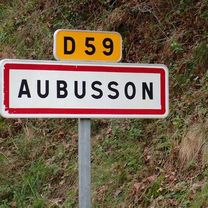
The last ten kilometers or so into Aubusson were a very gradual downhill. Nice way to end the ride.
- 5 h 32 min
- Duration
- 54.1 km
- Distance
- 717 m
- Ascent
- 762 m
- Descent
- 9.8 km/h
- Avg. speed
- 767 m
- Max. altitude
created this 3 months ago
Route photos
Route quality
Waytypes & surfaces along the route
Waytypes
Road
35.2 km
(65 %)
Quiet road
1.1 km
(2 %)
Undefined
17.9 km
(33 %)
Surfaces
Paved
17.3 km
(32 %)
Asphalt
17.3 km
(32 %)
Undefined
36.8 km
(68 %)
Continue with Bikemap
Use, edit, or download this cycling route
You would like to ride Peyrat-le-Château to Aubusson - V87 part of way or customize it for your own trip? Here is what you can do with this Bikemap route:
Free features
- Save this route as favorite or in collections
- Copy & plan your own version of this route
- Sync your route with Garmin or Wahoo
Premium features
Free trial for 3 days, or one-time payment. More about Bikemap Premium.
- Navigate this route on iOS & Android
- Export a GPX / KML file of this route
- Create your custom printout (try it for free)
- Download this route for offline navigation
Discover more Premium features.
Get Bikemap PremiumFrom our community
Other popular routes starting in Peyrat-le-Château
- Peyrat-le-Château to Aubusson - V87 part of way
- Day 12
- 72.9 km
- 715 m
- 695 m
- Peyrat-le-Château, Nouvelle-Aquitaine, France
- E2018 #5 Vassivière - Argentat
- 119.7 km
- 716 m
- 1,188 m
- Peyrat-le-Château, Nouvelle-Aquitaine, France
- De Rue Camille Benassy 4, Royère-de-Vassivière à Boulevard de la Liberté 1, Saint-Nazaire
- 653 km
- 5,767 m
- 6,500 m
- Peyrat-le-Château, Nouvelle-Aquitaine, France
- Saint-Marcel - Châteaumeillant
- 80.3 km
- 1,196 m
- 1,396 m
- Peyrat-le-Château, Nouvelle-Aquitaine, France
- 1 Place du Champ de Foire, Peyrat-le-Château to Peyrat-le-Château
- 7 km
- 271 m
- 29 m
- Peyrat-le-Château, Nouvelle-Aquitaine, France
- Pierrefitte- Dijon
- 483.4 km
- 1,017 m
- 1,430 m
- Peyrat-le-Château, Nouvelle-Aquitaine, France
- Peyrat-le-Château to 12 Route de la Plage, Neuvic
- 81 km
- 1,186 m
- 1,225 m
- Peyrat-le-Château, Nouvelle-Aquitaine, France
Open it in the app

