
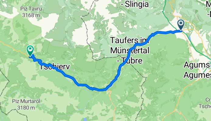
PASS DAL FUORN/ OFENPASS (por Glurns/ Glorenza)
A cycling route starting in Glurns, Trentino-Alto Adige, Italy.
Overview
About this route
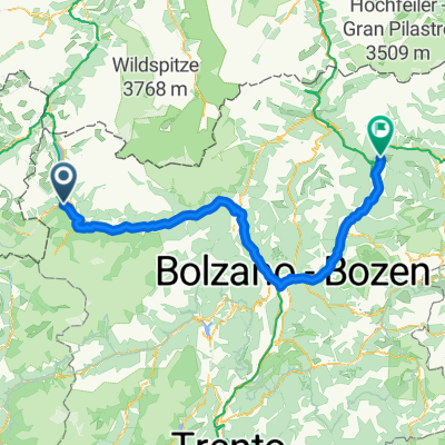
The Pass dal Fuorn, known in German as the Ofenpass, is one of the most representative passes of the canton of Graubünden in Switzerland. It connects the Engadine valley with the Val Müstair region, serving as a natural link between Switzerland and Italy. Its summit reaches 2149 m in altitude, crossing the heart of the Swiss National Park, which makes the route a natural spectacle, surrounded by dense forests, alpine meadows and a landscape that steadily gains elevation and toughens in the final section. It is also a pass of great historical and cultural importance, as it has been a route for communication and trade for centuries. Today it is a road used by both vehicles and cyclists seeking the beauty of its scenery and the challenge of its ascent.
- 1 h 58 min
- Duration
- 28.6 km
- Distance
- 1,396 m
- Ascent
- 156 m
- Descent
- 14.5 km/h
- Avg. speed
- 2,154 m
- Max. altitude

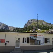
Route photos
\"")
Route quality
Waytypes & surfaces along the route
Waytypes
Track
0.9 km
(3 %)
Access road
0.3 km
(1 %)
Surfaces
Paved
26.3 km
(92 %)
Unpaved
0.6 km
(2 %)
Asphalt
26.3 km
(92 %)
Gravel
0.3 km
(1 %)
Continue with Bikemap
Use, edit, or download this cycling route
You would like to ride PASS DAL FUORN/ OFENPASS (por Glurns/ Glorenza) or customize it for your own trip? Here is what you can do with this Bikemap route:
Free features
- Save this route as favorite or in collections
- Copy & plan your own version of this route
- Sync your route with Garmin or Wahoo
Premium features
Free trial for 3 days, or one-time payment. More about Bikemap Premium.
- Navigate this route on iOS & Android
- Export a GPX / KML file of this route
- Create your custom printout (try it for free)
- Download this route for offline navigation
Discover more Premium features.
Get Bikemap PremiumFrom our community
Other popular routes starting in Glurns
 PASS DAL FUORN/ OFENPASS (por Glurns/ Glorenza)
- Distance
- 28.6 km
- Ascent
- 1,396 m
- Descent
- 156 m
- Location
- Glurns, Trentino-Alto Adige, Italy
 Silbergasse nach Silbergasse
- Distance
- 68 km
- Ascent
- 2,693 m
- Descent
- 2,692 m
- Location
- Glurns, Trentino-Alto Adige, Italy
 🚴♀️E*Bike🇮🇩+🇨🇭 Glurns-STILFSER-JOCH-Glurns
- Distance
- 66 km
- Ascent
- 1,844 m
- Descent
- 1,841 m
- Location
- Glurns, Trentino-Alto Adige, Italy
 Preko tri drzave s autom
- Distance
- 133.4 km
- Ascent
- 1,813 m
- Descent
- 1,808 m
- Location
- Glurns, Trentino-Alto Adige, Italy
 OrtlerRunde
- Distance
- 314.8 km
- Ascent
- 9,655 m
- Descent
- 9,655 m
- Location
- Glurns, Trentino-Alto Adige, Italy
 Wiesenweg nach Glurns
- Distance
- 12.5 km
- Ascent
- 1,244 m
- Descent
- 172 m
- Location
- Glurns, Trentino-Alto Adige, Italy
 restt
restt- Distance
- 455.9 km
- Ascent
- 6,196 m
- Descent
- 6,836 m
- Location
- Glurns, Trentino-Alto Adige, Italy
 7 - Von Mals bis Bozen
- Distance
- 142.7 km
- Ascent
- 1,561 m
- Descent
- 1,667 m
- Location
- Glurns, Trentino-Alto Adige, Italy
Open it in the app