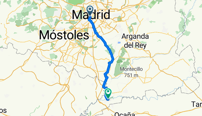
Calle del Codo, Madrid to El cocheron 1910 Calle de Montesinos, Aranjuez
A cycling route starting in Madrid, Madrid, Spain.
Overview
About this route
- 3 h 35 min
- Duration
- 54.8 km
- Distance
- 303 m
- Ascent
- 460 m
- Descent
- 15.3 km/h
- Avg. speed
- 667 m
- Max. altitude
Route quality
Waytypes & surfaces along the route
Waytypes
- Cycleway - 20.8 km - (38 %) 
- Track - 13.1 km - (24 %) 
Surfaces
Paved
31.8 km
(58 %)
Unpaved
8.2 km
(15 %)
- Asphalt - 16.4 km - (30 %) 
- Paved (undefined) - 13.7 km - (25 %) 
Continue with Bikemap
Use, edit, or download this cycling route
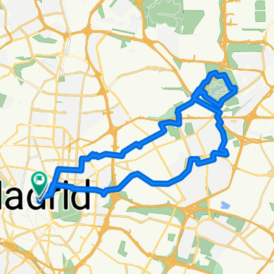
You would like to ride Calle del Codo, Madrid to El cocheron 1910 Calle de Montesinos, Aranjuez or customize it for your own trip? Here is what you can do with this Bikemap route:
Free features
- Save this route as favorite or in collections
- Copy & plan your own version of this route
- Sync your route with Garmin or Wahoo
Premium features
Free trial for 3 days, or one-time payment. More about Bikemap Premium.
- Navigate this route on iOS & Android
- Export a GPX / KML file of this route
- Create your custom printout (try it for free)
- Download this route for offline navigation
Discover more Premium features.
Get Bikemap PremiumFrom our community
Other popular routes starting in Madrid
 madrid valencia madrid valencia- Distance
- 395.9 km
- Ascent
- 1,570 m
- Descent
- 2,208 m
- Location
- Madrid, Madrid, Spain
 
 River and gardens route River and gardens route- Distance
- 13.3 km
- Ascent
- 99 m
- Descent
- 94 m
- Location
- Madrid, Madrid, Spain
 
 route to school route to school- Distance
- 7.8 km
- Ascent
- 119 m
- Descent
- 55 m
- Location
- Madrid, Madrid, Spain
 
 Calle del Codo, Madrid to El cocheron 1910 Calle de Montesinos, Aranjuez Calle del Codo, Madrid to El cocheron 1910 Calle de Montesinos, Aranjuez- Distance
- 54.8 km
- Ascent
- 303 m
- Descent
- 460 m
- Location
- Madrid, Madrid, Spain
 
 facultad de veterinario facultad de veterinario- Distance
- 8.8 km
- Ascent
- 42 m
- Descent
- 35 m
- Location
- Madrid, Madrid, Spain
 
 Calle de Cobos de Segovia, Madrid a Paseo Melancolicos, Madrid Calle de Cobos de Segovia, Madrid a Paseo Melancolicos, Madrid- Distance
- 22.5 km
- Ascent
- 69 m
- Descent
- 67 m
- Location
- Madrid, Madrid, Spain
 
 Paseo de Extremadura, 41–53, Madrid a Calle de Pericles, 28, Madrid Paseo de Extremadura, 41–53, Madrid a Calle de Pericles, 28, Madrid- Distance
- 25.7 km
- Ascent
- 647 m
- Descent
- 640 m
- Location
- Madrid, Madrid, Spain
 
 Madrid - Fuensalida Madrid - Fuensalida- Distance
- 73.6 km
- Ascent
- 559 m
- Descent
- 650 m
- Location
- Madrid, Madrid, Spain
 
Open it in the app

