
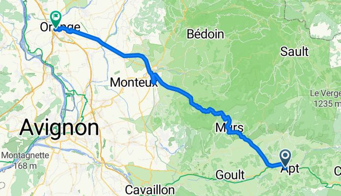
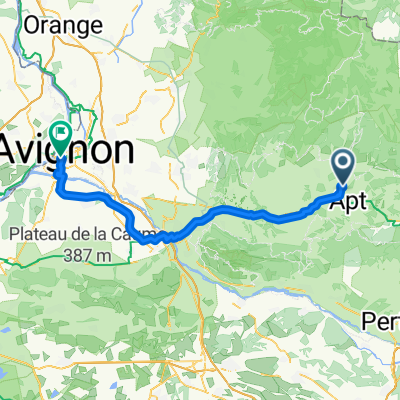
Apt to Orange
A cycling route starting in Apt, Provence-Alpes-Côte d'Azur Region, France.
Overview
About this route
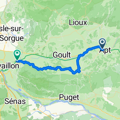
This was a great route with mostly gradual climbing on a low-traffic road to the Col de Murs at 627 meters.
The southern loop in Carpentras was due to our getting momentarily lost. Anyone following this route should ignore that loop to the south.
The Via Venaissia (V861) was a really easy and car-free way to get from Carpentras to Orange. The entire way was well-paved and in excellent condition.
- 24 h 44 min
- Duration
- 72.6 km
- Distance
- 693 m
- Ascent
- 883 m
- Descent
- 2.9 km/h
- Avg. speed
- 628 m
- Max. altitude

Route photos


Route quality
Waytypes & surfaces along the route
Waytypes
Path
23.2 km
(32 %)
Road
12.3 km
(17 %)
Surfaces
Paved
62.4 km
(86 %)
Asphalt
62.4 km
(86 %)
Undefined
10.2 km
(14 %)
Continue with Bikemap
Use, edit, or download this cycling route
You would like to ride Apt to Orange or customize it for your own trip? Here is what you can do with this Bikemap route:
Free features
- Save this route as favorite or in collections
- Copy & plan your own version of this route
- Sync your route with Garmin or Wahoo
Premium features
Free trial for 3 days, or one-time payment. More about Bikemap Premium.
- Navigate this route on iOS & Android
- Export a GPX / KML file of this route
- Create your custom printout (try it for free)
- Download this route for offline navigation
Discover more Premium features.
Get Bikemap PremiumFrom our community
Other popular routes starting in Apt
 Rustrel-Sault
- Distance
- 30.6 km
- Ascent
- 910 m
- Descent
- 567 m
- Location
- Apt, Provence-Alpes-Côte d'Azur Region, France
 Voie Domitienne, Apt à Chemin des Vautes, Cavaillon
- Distance
- 39.3 km
- Ascent
- 754 m
- Descent
- 901 m
- Location
- Apt, Provence-Alpes-Côte d'Azur Region, France
 2010 06 29 - Apt
- Distance
- 68.2 km
- Ascent
- 744 m
- Descent
- 733 m
- Location
- Apt, Provence-Alpes-Côte d'Azur Region, France
 5 - Apt - Saint-Etienne-les-Orgues
- Distance
- 67.2 km
- Ascent
- 1,430 m
- Descent
- 971 m
- Location
- Apt, Provence-Alpes-Côte d'Azur Region, France
 Apt à Apt
- Distance
- 45 km
- Ascent
- 723 m
- Descent
- 720 m
- Location
- Apt, Provence-Alpes-Côte d'Azur Region, France
 Route to Avignon
- Distance
- 67.9 km
- Ascent
- 79 m
- Descent
- 283 m
- Location
- Apt, Provence-Alpes-Côte d'Azur Region, France
 Vacances - Murs Luberon
- Distance
- 19.4 km
- Ascent
- 386 m
- Descent
- 405 m
- Location
- Apt, Provence-Alpes-Côte d'Azur Region, France
 Apt to Orange
- Distance
- 72.6 km
- Ascent
- 693 m
- Descent
- 883 m
- Location
- Apt, Provence-Alpes-Côte d'Azur Region, France
Open it in the app