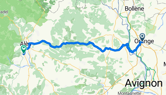

Runde Orange ca 67km Body House
- 66 km
- 338 m
- 337 m
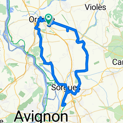
- Orange, Provence-Alpes-Côte d'Azur Region, France
A cycling route starting in Orange, Provence-Alpes-Côte d'Azur Region, France.
Overview
D17 was a great road to departing from Orange. Little traffic and some road shoulder.
The EV17 bike path was very well done and was a very pleasant and quiet couple of kilometers.
When we first got onto D9, it was an arterial and there was great road shoulder. After crossing D6086, D9 became a great country road perfect for cycling.
Getting to D6, it is a major arterial. However, traffic was light to moderate and there's almost always at least a little shoulder to ride on. Often the shoulder was very narrow (as little as, say, 30 cm), which wasn't great. But we found D6 to be acceptable. It also had some nice scenic sections.
D60 and D6110 were major artierials with too much traffic and some giant traffic circles. It would have been much better to have missed D60 completely by continuing west on D6 into the center of Alès and then crossed the river and turned south on smaller roads.
Overall, great ride.
created this 1 month ago


Route quality
Road
7.9 km
(10 %)
Quiet road
6.3 km
(8 %)
Paved
46.3 km
(59 %)
Asphalt
46.3 km
(59 %)
Undefined
32.2 km
(41 %)
Continue with Bikemap
You would like to ride Orange to St-Christol-Lez-Arès or customize it for your own trip? Here is what you can do with this Bikemap route:
Free trial for 3 days, or one-time payment. More about Bikemap Premium.
Discover more Premium features.
Get Bikemap PremiumFrom our community
Open it in the app