


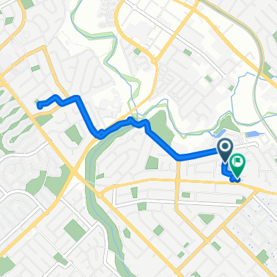
Bickley Reservoir Hike
A cycling route starting in Maddington, Western Australia, Australia.
Overview
About this route
0
Failed hike due to Sickness (Vertigo from vestibular ear issues)
- 52 min
- Duration
- 3.2 km
- Distance
- 94 m
- Ascent
- 46 m
- Descent
- 3.7 km/h
- Avg. speed
- 134 m
- Max. altitude
Willfred Stock
created this 6 months ago
Route photos


Route quality
Waytypes & surfaces along the route
Waytypes
Access road
2.5 km
79 %
Road
0.3 km
10 %
Surfaces
Paved
0.6 km
(19 %)
Unpaved
2.5 km
(79 %)
Unpaved (undefined)
2.5 km
79 %
Paved (undefined)
0.6 km
19 %
Undefined
0.1 km
2 %
Continue with Bikemap
Use, edit, or download this cycling route
You would like to ride Bickley Reservoir Hike or customize it for your own trip? Here is what you can do with this Bikemap route:
Free features
- Save this route as favorite or in collections
- Copy & plan your own version of this route
- Sync your route with Garmin or Wahoo
Premium features
Free trial for 3 days, or one-time payment. More about Bikemap Premium.
- Navigate this route on iOS & Android
- Export a GPX / KML file of this route
- Create your custom printout (try it for free)
- Download this route for offline navigation
Discover more Premium features.
Get Bikemap PremiumFrom our community
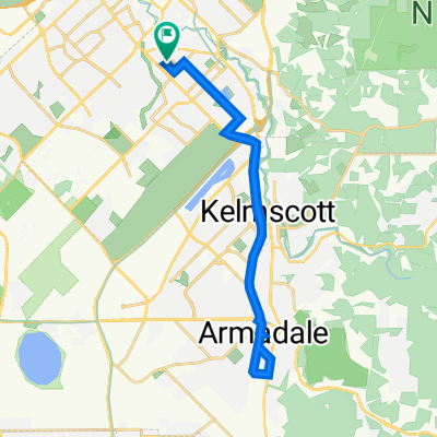
Other popular routes starting in Maddington

 26 Ospringe St, Gosnells to 29 Durham Rd, Bayswater0
- 27.1 km
- 102 m
- 111 m
- Maddington, Western Australia, Australia
 26 Ospringe St, Gosnells to 26 Ospringe St, Gosnells0
- 27.1 km
- 89 m
- 88 m
- Maddington, Western Australia, Australia
 24 Ospringe St, Gosnells to 7 Chullora Bend, Jandakot0
- 16.8 km
- 22 m
- 13 m
- Maddington, Western Australia, Australia
 26 Ospringe St, Gosnells to 7 Chullora Bend, Jandakot0
- 22.4 km
- 39 m
- 28 m
- Maddington, Western Australia, Australia

 26 Ospringe St, Gosnells to 7 Chullora Bend, Jandakot0
- 18 km
- 32 m
- 19 m
- Maddington, Western Australia, Australia


Open it in the app