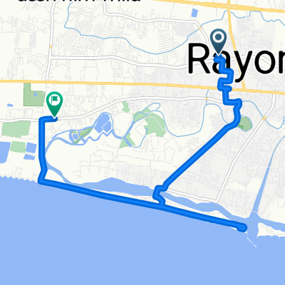
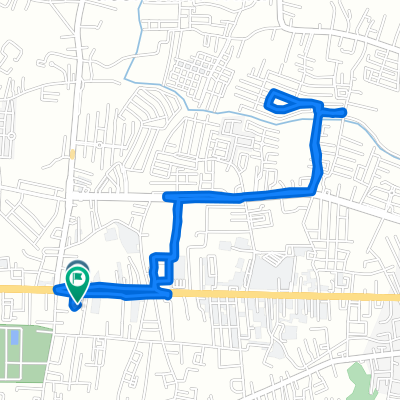
From Amphoe Mueang Rayong to Vientiane
Rayong - Bo Thong
A cycling route starting in Rayong, Rayong, Thailand.OverviewAbout this route
- 5 h 57 min
- Duration
- 98.3 km
- Distance
- 1,070 m
- Ascent
- 1,009 m
- Descent
- 16.5 km/h
- Avg. speed
- 149 m
- Max. altitude
bikemapuser4313820611640829created this 3 months ago
Route qualityWaytypes & surfaces along the route
Waytypes
Quiet road
58 km59 %Road
34.4 km35 %
Surfaces
Paved
42.3 km(43 %)Unpaved
7.9 km(8 %)Asphalt
32.4 km33 %Unpaved (undefined)
7.9 km8 %
Free features
- Save this route as favorite or in collections
- Copy & plan your own version of this route
- Split it into stages to create a multi-day tour
- Sync your route with Garmin or Wahoo
Premium features
Free trial for 3 days, or one-time payment. More about Bikemap Premium.
- Navigate this route on iOS & Android
- Export a GPX / KML file of this route
- Create your custom printout (try it for free)
- Download this route for offline navigation
Discover more Premium features.
Get Bikemap Premium- ride through āļ.āđāļĄāļ·āļāļāļĢāļ°āļĒāļāļ
- 19.9 km
- 29 m
- 30 m
- Rayong, Rayong, Thailand
- Soi Bohnkai, Amphoe Mueang Rayong to Thanon Rajbamrung, Amphoe Mueang Rayong
- 12.8 km
- 3 m
- 10 m
- Rayong, Rayong, Thailand
- āļāļąāđāļāđāļĨāđāļ4āļāļĄ.
- 6 km
- 20 m
- 17 m
- Rayong, Rayong, Thailand
- 167/3 Soi Sukhumvit Nakornrayong 64, Mueang Rayong to 167/3 Soi Sukhumvit Nakornrayong 64, Mueang Rayong
- 45.4 km
- 3 m
- 10 m
- Rayong, Rayong, Thailand
- Rayong - Bo Thong
- 98.3 km
- 1,070 m
- 1,009 m
- Rayong, Rayong, Thailand
- āļāļāļāļŦāļĨāļąāļāļāļģāđāļ āļ, āļ.āđāļĄāļ·āļāļāļĢāļ°āļĒāļāļ to āļāļāļāļŦāļĨāļąāļāļāļģāđāļ āļ, āļ.āđāļĄāļ·āļāļāļĢāļ°āļĒāļāļ
- 53 km
- 131 m
- 128 m
- Rayong, Rayong, Thailand
Open it in the app


