

De Lannion à Les Lilas
Brou - Rambouillet
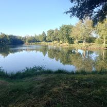
A cycling route starting in Brou, Centre-Val de Loire, France.
Overview
About this route
0
- 5:01 h
- Duration
- 86.7 km
- Distance
- 390 m
- Ascent
- 428 m
- Descent
- 17.3 km/h
- Avg. speed
- 207 m
- Max. altitude
Lintanfclaude
created this 3 months ago
Part of
De Lannion à Les Lilas
8 stages
Route quality
Waytypes & surfaces along the route
Waytypes
Road
35.5 km
41 %
Quiet road
21.7 km
25 %
Surfaces
Paved
67.6 km
(78 %)
Unpaved
4.3 km
(5 %)
Asphalt
66.8 km
77 %
Gravel
2.6 km
3 %
Continue with Bikemap
Use, edit, or download this cycling route
You would like to ride Brou - Rambouillet or customize it for your own trip? Here is what you can do with this Bikemap route:
Free features
- Save this route as favorite or in collections
- Copy & plan your own version of this route
- Split it into stages to create a multi-day tour
- Sync your route with Garmin or Wahoo
Premium features
Free trial for 3 days, or one-time payment. More about Bikemap Premium.
- Navigate this route on iOS & Android
- Export a GPX / KML file of this route
- Create your custom printout (try it for free)
- Download this route for offline navigation
Discover more Premium features.
Get Bikemap PremiumFrom our community
Other popular routes starting in Brou
- De L'Océane, Vieuvicq à 28 Rue de la Herse, Nogent-le-Rotrou0
- 42.5 km
- 356 m
- 407 m
- Brou, Centre-Val de Loire, France
- De D126, Méréglise à 16 Avenue Georges Clemenceau, Illiers-Combray0
- 6.5 km
- 32 m
- 33 m
- Brou, Centre-Val de Loire, France


Open it in the app