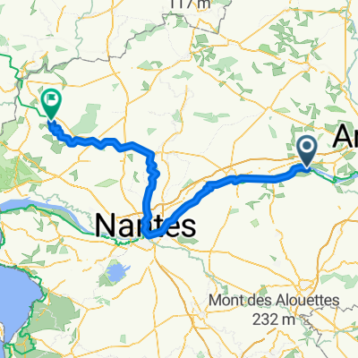
0
- 28.7 km
- 54 m
- 58 m
- Montjean-sur-Loire, Pays de la Loire Region, France
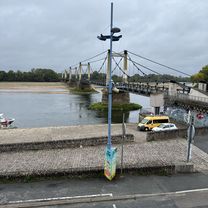
A cycling route starting in Montjean-sur-Loire, Pays de la Loire Region, France.
Overview
The route starts in the city center and heads out on a paved path, passing through a park before climbing into rolling countryside. The path becomes a dirt road for a short stretch before returning to paved surface and descending into a valley. The route continues on
AI generated
created this 1 month ago
Route quality
Road
12.3 km
43 %
Quiet road
9.5 km
33 %
Paved
23.2 km
(81 %)
Unpaved
5.2 km
(18 %)
Asphalt
21.8 km
76 %
Loose gravel
4.6 km
16 %
Continue with Bikemap
You would like to ride LV24 Montjean to Ancenis.kml_LV24 Montjean to Ancenis or customize it for your own trip? Here is what you can do with this Bikemap route:
Free trial for 3 days, or one-time payment. More about Bikemap Premium.
Discover more Premium features.
Get Bikemap PremiumFrom our community
Open it in the app