

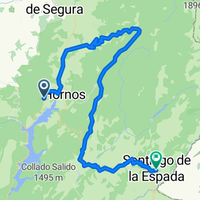
Beas de Segura - La Cumbre - Despiernacaballos
A cycling route starting in Beas de Segura, Andalusia, Spain.
Overview
About this route
La Cumbre:
www.altimetrias.net/aspbk/verPerfilusu.asp?id=864
Despiernacaballos :
apmforo.mforos.com/1934457/10728766-propuesta-n-59-inclusion-alto-de-despiernacaballos/
- -:--
- Duration
- 132.7 km
- Distance
- 2,324 m
- Ascent
- 2,329 m
- Descent
- ---
- Avg. speed
- ---
- Max. altitude

Route quality
Waytypes & surfaces along the route
Waytypes
Road
77 km
(58 %)
Quiet road
11.9 km
(9 %)
Surfaces
Paved
128.7 km
(97 %)
Asphalt
128.7 km
(97 %)
Undefined
4 km
(3 %)
Continue with Bikemap
Use, edit, or download this cycling route
You would like to ride Beas de Segura - La Cumbre - Despiernacaballos or customize it for your own trip? Here is what you can do with this Bikemap route:
Free features
- Save this route as favorite or in collections
- Copy & plan your own version of this route
- Split it into stages to create a multi-day tour
- Sync your route with Garmin or Wahoo
Premium features
Free trial for 3 days, or one-time payment. More about Bikemap Premium.
- Navigate this route on iOS & Android
- Export a GPX / KML file of this route
- Create your custom printout (try it for free)
- Download this route for offline navigation
Discover more Premium features.
Get Bikemap PremiumFrom our community
Other popular routes starting in Beas de Segura
 Jaen 4: Beas de Segura - Aldeahermosa
- Distance
- 32.7 km
- Ascent
- 419 m
- Descent
- 353 m
- Location
- Beas de Segura, Andalusia, Spain
 Rodeando el Tranco
- Distance
- 65.9 km
- Ascent
- 761 m
- Descent
- 761 m
- Location
- Beas de Segura, Andalusia, Spain
 Hostal Losam to Santiago via Segura
- Distance
- 75.2 km
- Ascent
- 1,272 m
- Descent
- 715 m
- Location
- Beas de Segura, Andalusia, Spain
 Tranco Hoya Conejos Cerro Peguera Hoya Trevejiles
- Distance
- 37.8 km
- Ascent
- 989 m
- Descent
- 996 m
- Location
- Beas de Segura, Andalusia, Spain
 Segura y Las Villas
- Distance
- 186.6 km
- Ascent
- 2,691 m
- Descent
- 2,713 m
- Location
- Beas de Segura, Andalusia, Spain
 Segura XTRI Ciclismo
- Distance
- 186.5 km
- Ascent
- 7,323 m
- Descent
- 7,318 m
- Location
- Beas de Segura, Andalusia, Spain
 Segura XTRI Trailrun
- Distance
- 38.2 km
- Ascent
- 1,437 m
- Descent
- 922 m
- Location
- Beas de Segura, Andalusia, Spain
 La Segureña
- Distance
- 124.2 km
- Ascent
- 1,553 m
- Descent
- 1,575 m
- Location
- Beas de Segura, Andalusia, Spain
Open it in the app