

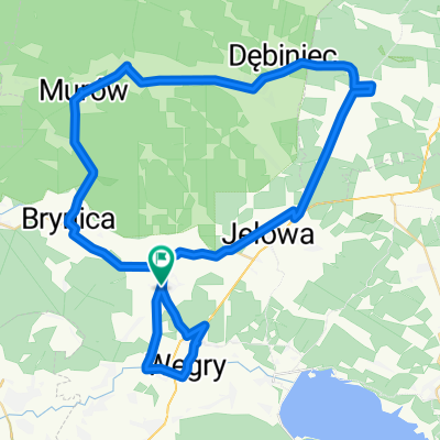
Droga Krajowa 45, Jełowa do Droga Krajowa 45, Jełowa
A cycling route starting in Gmina Łubniany, Opole Voivodeship, Poland.
Overview
About this route
0
- 2:50 h
- Duration
- 31.1 km
- Distance
- 186 m
- Ascent
- 187 m
- Descent
- 11 km/h
- Avg. speed
- 196 m
- Max. altitude
Ryszard Kansy
created this 24 days ago
Route quality
Waytypes & surfaces along the route
Waytypes
Quiet road
8.7 km
28 %
Path
5 km
16 %
Surfaces
Paved
17.4 km
(56 %)
Asphalt
17.4 km
56 %
Undefined
13.7 km
44 %
Continue with Bikemap
Use, edit, or download this cycling route
You would like to ride Droga Krajowa 45, Jełowa do Droga Krajowa 45, Jełowa or customize it for your own trip? Here is what you can do with this Bikemap route:
Free features
- Save this route as favorite or in collections
- Copy & plan your own version of this route
- Sync your route with Garmin or Wahoo
Premium features
Free trial for 3 days, or one-time payment. More about Bikemap Premium.
- Navigate this route on iOS & Android
- Export a GPX / KML file of this route
- Create your custom printout (try it for free)
- Download this route for offline navigation
Discover more Premium features.
Get Bikemap PremiumFrom our community
Other popular routes starting in Gmina Łubniany
- Droga Krajowa 45, Jełowa do Droga Krajowa 45, Jełowa0
- 31.1 km
- 186 m
- 187 m
- Gmina Łubniany, Opole Voivodeship, Poland
- Droga Krajowa 45, Jełowa do Droga Krajowa 45, Jełowa0
- 19.9 km
- 173 m
- 171 m
- Gmina Łubniany, Opole Voivodeship, Poland
- Opolska 110A, Łubniany do Opolska 110A, Łubniany0
- 75.4 km
- 219 m
- 219 m
- Gmina Łubniany, Opole Voivodeship, Poland
- Opolska 110a, Łubniany do plac Myśliwca 1, Kamień Śląski0
- 37.4 km
- 176 m
- 149 m
- Gmina Łubniany, Opole Voivodeship, Poland
- Opolska 110A, Łubniany do Strażacka 6A, Mechnice0
- 21.6 km
- 36 m
- 96 m
- Gmina Łubniany, Opole Voivodeship, Poland


Open it in the app