2012 French Tour -- Ride Day 47 -- 7 October 2012 -- Courmes -- Circle
- 77.8 km
- 1,580 m
- 1,580 m
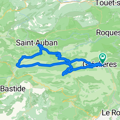
- Tourrettes-sur-Loup, Provence-Alpes-Côte d'Azur Region, France
A cycling route starting in Tourrettes-sur-Loup, Provence-Alpes-Côte d'Azur Region, France.
Overview
To be added later...
The majority of the ride was on great low traffic roads, but the portion from just before the Col de l'Êcre to Pont-du-Loup did have some traffic. It was definitely OK riding, but there was traffic.
For those who like very gradual climbs, D79 was great. And for those who like fast descents, the entire portion from the Col de l'Êcre at 1120 M to Pont-du-Loup was just continual descending. Enjoy it. <div><br /></div>
created this 13 years ago
Route quality
Road
45.1 km
(58 %)
Quiet road
1.6 km
(2 %)
Paved
22.6 km
(29 %)
Asphalt
22.6 km
(29 %)
Undefined
55.2 km
(71 %)
Continue with Bikemap
You would like to ride 2012 French Tour -- Ride Day 47 -- 7 October 2012 -- Courmes -- Circle or customize it for your own trip? Here is what you can do with this Bikemap route:
Free trial for 3 days, or one-time payment. More about Bikemap Premium.
Discover more Premium features.
Get Bikemap PremiumFrom our community
Open it in the app