

Selva di Val Gardena (1560 m) - Plan de Gralba (1806 m) - Grödner Joch (2121 m) - Corvara (ca. 1540 m) - Campolongopass (1875 m) - Saviner di Laste (1010 m) - C
Cencenighe Agordino - Canazei
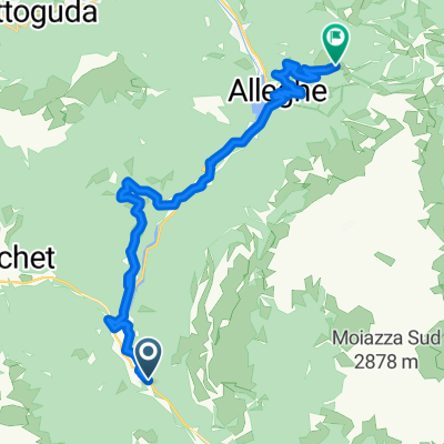
A cycling route starting in Cencenighe Agordino, Veneto, Italy.
Overview
About this route
0
- 3:36 h
- Duration
- 47.5 km
- Distance
- 1,331 m
- Ascent
- 944 m
- Descent
- 13.2 km/h
- Avg. speed
- 1,921 m
- Max. altitude
Tomasz Przeradzki
created this 23 days ago
Part of
Route quality
Waytypes & surfaces along the route
Waytypes
Quiet road
4.3 km
9 %
Road
1.9 km
4 %
Surfaces
Paved
28.5 km
(60 %)
Unpaved
1.4 km
(3 %)
Asphalt
28.5 km
60 %
Gravel
0.9 km
2 %
Continue with Bikemap
Use, edit, or download this cycling route
You would like to ride Cencenighe Agordino - Canazei or customize it for your own trip? Here is what you can do with this Bikemap route:
Free features
- Save this route as favorite or in collections
- Copy & plan your own version of this route
- Sync your route with Garmin or Wahoo
Premium features
Free trial for 3 days, or one-time payment. More about Bikemap Premium.
- Navigate this route on iOS & Android
- Export a GPX / KML file of this route
- Create your custom printout (try it for free)
- Download this route for offline navigation
Discover more Premium features.
Get Bikemap PremiumFrom our community
Other popular routes starting in Cencenighe Agordino
- Belluno Dolomitak - Cencenigue Agordino - Arabba0
- 159.3 km
- 4,923 m
- 4,095 m
- Cencenighe Agordino, Veneto, Italy
- Caprile - Valles - Rolle - Cereda - Aurino - Agordo - Caprile0
- 89.9 km
- 2,630 m
- 2,628 m
- Cencenighe Agordino, Veneto, Italy


Open it in the app