

OWL Lippe: Hermann-Gauseköte-Oerlinghausen
A cycling route starting in Lage, North Rhine-Westphalia, Germany.
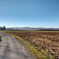
Overview
About this route
<p>Route:</p>
<p>Start: Lage</p>
<p>1. Pivitsheide/Donopperteiche</p>
<p>2. Hermann (steep)</p>
<p>3. Gauseköte (very steep)</p>
<p>4. Kreuzkrug and through the Senne to Augustdorf</p>
<p>5. Gliderport Oerlinghausen</p>
<p>6. Loop over the A2 bridge</p>
<p>7. Oerlinghausen 'City'</p>
<p>8. Helpup (ice cream shop;) )</p>
<p>9. and...back</p>
<p></p>
<p>Have fun,</p>
<p>Tobi</p>
Translated, show original (German)- -:--
- Duration
- 87.1 km
- Distance
- 772 m
- Ascent
- 772 m
- Descent
- ---
- Avg. speed
- ---
- Max. altitude

Route highlights
Points of interest along the route

Point of interest after 21.8 km
Hermannsdenkmal
Continue with Bikemap
Use, edit, or download this cycling route
You would like to ride OWL Lippe: Hermann-Gauseköte-Oerlinghausen or customize it for your own trip? Here is what you can do with this Bikemap route:
Free features
- Save this route as favorite or in collections
- Copy & plan your own version of this route
- Split it into stages to create a multi-day tour
- Sync your route with Garmin or Wahoo
Premium features
Free trial for 3 days, or one-time payment. More about Bikemap Premium.
- Navigate this route on iOS & Android
- Export a GPX / KML file of this route
- Create your custom printout (try it for free)
- Download this route for offline navigation
Discover more Premium features.
Get Bikemap PremiumFrom our community
Other popular routes starting in Lage
 Von Lage zur Stadthalle in Bielefeld und über Bad Salzuflen zurück
- Distance
- 54.4 km
- Ascent
- 191 m
- Descent
- 193 m
- Location
- Lage, North Rhine-Westphalia, Germany
 OWL Lippe: Hermann-Gauseköte-Oerlinghausen
- Distance
- 89.9 km
- Ascent
- 676 m
- Descent
- 676 m
- Location
- Lage, North Rhine-Westphalia, Germany
 Segelflugplatz und Wasserpark
- Distance
- 44 km
- Ascent
- 271 m
- Descent
- 270 m
- Location
- Lage, North Rhine-Westphalia, Germany
 zu den Externsteinen
- Distance
- 43.8 km
- Ascent
- 243 m
- Descent
- 243 m
- Location
- Lage, North Rhine-Westphalia, Germany
 OWL Lippe: Hermann-Gauseköte-Oerlinghausen
- Distance
- 87.1 km
- Ascent
- 772 m
- Descent
- 772 m
- Location
- Lage, North Rhine-Westphalia, Germany
 Bismarcktour
- Distance
- 52.9 km
- Ascent
- 568 m
- Descent
- 565 m
- Location
- Lage, North Rhine-Westphalia, Germany
 Sonntagmorgen Rundtour zum Skypoint Detmold und zurück.
- Distance
- 25.8 km
- Ascent
- 114 m
- Descent
- 113 m
- Location
- Lage, North Rhine-Westphalia, Germany
 Lage Hermannsdenkmal
- Distance
- 28.7 km
- Ascent
- 386 m
- Descent
- 385 m
- Location
- Lage, North Rhine-Westphalia, Germany
Open it in the app