
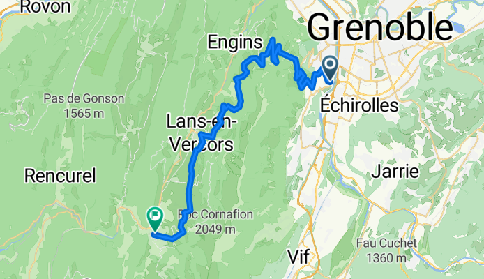
2009 J1 Seyssins - Villars de Lans
A cycling route starting in Seyssins, Auvergne-Rhône-Alpes, France.
Overview
About this route
Bike tour with Blaise & Guy in France.
- -:--
- Duration
- 34 km
- Distance
- 1,079 m
- Ascent
- 282 m
- Descent
- ---
- Avg. speed
- ---
- Max. altitude

Route quality
Waytypes & surfaces along the route
Waytypes
Road
9.5 km
(28 %)
Quiet road
0.7 km
(2 %)
Surfaces
Paved
28.3 km
(83 %)
Asphalt
28.3 km
(83 %)
Undefined
5.8 km
(17 %)
Continue with Bikemap
Use, edit, or download this cycling route
You would like to ride 2009 J1 Seyssins - Villars de Lans or customize it for your own trip? Here is what you can do with this Bikemap route:
Free features
- Save this route as favorite or in collections
- Copy & plan your own version of this route
- Sync your route with Garmin or Wahoo
Premium features
Free trial for 3 days, or one-time payment. More about Bikemap Premium.
- Navigate this route on iOS & Android
- Export a GPX / KML file of this route
- Create your custom printout (try it for free)
- Download this route for offline navigation
Discover more Premium features.
Get Bikemap PremiumFrom our community
Other popular routes starting in Seyssins
 Le Moucherotte FR sneeuwracket 9km
- Distance
- 9 km
- Ascent
- 880 m
- Descent
- 880 m
- Location
- Seyssins, Auvergne-Rhône-Alpes, France
 Itineraire Saint Nizier -Roynac en vélo de route
- Distance
- 138.6 km
- Ascent
- 726 m
- Descent
- 1,574 m
- Location
- Seyssins, Auvergne-Rhône-Alpes, France
 randovélo : grenoble - mimizan plage
- Distance
- 819.4 km
- Ascent
- 11,695 m
- Descent
- 12,790 m
- Location
- Seyssins, Auvergne-Rhône-Alpes, France
 Grenoble-Sestriere
- Distance
- 167.1 km
- Ascent
- 3,732 m
- Descent
- 2,130 m
- Location
- Seyssins, Auvergne-Rhône-Alpes, France
 2019 - 6a - ok
- Distance
- 79.3 km
- Ascent
- 1,806 m
- Descent
- 1,310 m
- Location
- Seyssins, Auvergne-Rhône-Alpes, France
 MID - Champagnier - Vif - Varces - MID
- Distance
- 35.7 km
- Ascent
- 303 m
- Descent
- 303 m
- Location
- Seyssins, Auvergne-Rhône-Alpes, France
 2012 French Tour -- Ride Day 37-- 25 September 2012 -- Seyssins (Grenoble) to Corps-la-Salette
- Distance
- 71.1 km
- Ascent
- 1,352 m
- Descent
- 639 m
- Location
- Seyssins, Auvergne-Rhône-Alpes, France
 TP Iain Day 1
- Distance
- 52.6 km
- Ascent
- 1,615 m
- Descent
- 1,840 m
- Location
- Seyssins, Auvergne-Rhône-Alpes, France
Open it in the app