

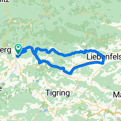
MTB-Flach: FE - Villach
A cycling route starting in Feldkirchen in Kärnten, Carinthia, Austria.
Overview
About this route
Unser Land erfahren 2020
Strecke Feldkirchen - Villach
- -:--
- Duration
- 27.6 km
- Distance
- 154 m
- Ascent
- 202 m
- Descent
- ---
- Avg. speed
- ---
- Max. altitude

Route quality
Waytypes & surfaces along the route
Waytypes
Cycleway
11.2 km
(41 %)
Busy road
6.7 km
(24 %)
Surfaces
Paved
21.1 km
(76 %)
Unpaved
1.1 km
(4 %)
Asphalt
18.8 km
(68 %)
Paved (undefined)
2 km
(7 %)
Route highlights
Points of interest along the route
Point of interest after 11.7 km
Labestation Ossiach
Continue with Bikemap
Use, edit, or download this cycling route
You would like to ride MTB-Flach: FE - Villach or customize it for your own trip? Here is what you can do with this Bikemap route:
Free features
- Save this route as favorite or in collections
- Copy & plan your own version of this route
- Sync your route with Garmin or Wahoo
Premium features
Free trial for 3 days, or one-time payment. More about Bikemap Premium.
- Navigate this route on iOS & Android
- Export a GPX / KML file of this route
- Create your custom printout (try it for free)
- Download this route for offline navigation
Discover more Premium features.
Get Bikemap PremiumFrom our community
Other popular routes starting in Feldkirchen in Kärnten
 Sonnenuntergangsrunde
- Distance
- 20.4 km
- Ascent
- 175 m
- Descent
- 178 m
- Location
- Feldkirchen in Kärnten, Carinthia, Austria
 GRV-Flach: HA-FE-Ossiach-Treffen-Krastal-Drautal-Lendorf
- Distance
- 72.3 km
- Ascent
- 686 m
- Descent
- 713 m
- Location
- Feldkirchen in Kärnten, Carinthia, Austria
 Feldkirchen - Ulrichsberg - St. Veit/Glan - Sörg - St. Urban - Feldkirchen
- Distance
- 78 km
- Ascent
- 1,693 m
- Descent
- 1,678 m
- Location
- Feldkirchen in Kärnten, Carinthia, Austria
 RR-Berg: HA-Steuerberg-Köttern-Zedlitzberg-Himmelberg-Tiffen-Steindorf-Klachl-FE-HA
- Distance
- 43.5 km
- Ascent
- 621 m
- Descent
- 618 m
- Location
- Feldkirchen in Kärnten, Carinthia, Austria
 GRV-Berg: HA-St.Ulrich-Rogg-St.Martin-GlantalRadweg-Glanegg-Liebenfels-Limberg-St.Urban-Rogg-HA
- Distance
- 38.9 km
- Ascent
- 662 m
- Descent
- 661 m
- Location
- Feldkirchen in Kärnten, Carinthia, Austria
 Feldkirchen - Himmelberg - Tiffnerwinkel - Feldkirchen
- Distance
- 33.4 km
- Ascent
- 502 m
- Descent
- 501 m
- Location
- Feldkirchen in Kärnten, Carinthia, Austria
 RR-Berg: HA-FE-Himmelberg-Patergassen-BKK-Radenthein-Feld am See-Einöde-Treffen-Ossiach-Buchscheiden-FE-HA
- Distance
- 86 km
- Ascent
- 742 m
- Descent
- 742 m
- Location
- Feldkirchen in Kärnten, Carinthia, Austria
 Hügelige Runde Feldkirchen - Forstsee - Wernberg - Feldkirchen
- Distance
- 70.7 km
- Ascent
- 650 m
- Descent
- 650 m
- Location
- Feldkirchen in Kärnten, Carinthia, Austria
Open it in the app