

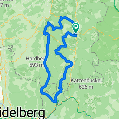
Von Hüttenthal nach Keilbach
A cycling route starting in Erbach im Odenwald, Hesse, Germany.
Overview
About this route
Beautiful day cycling tour from Hüttenthal to Keilbach/Hesseneck with challenging climbs, fast descents, lots of nature and fresh air. In Keilbach, you can stop at the inn 'Waldes Lust' to recharge for the return trip. Technically, the terrain offers quite a bit and there's something for everyone. A good hardtail or a full suspension bike is recommended.
I wish you lots of fun
- -:--
- Duration
- 24 km
- Distance
- 547 m
- Ascent
- 588 m
- Descent
- ---
- Avg. speed
- ---
- Max. altitude
Route quality
Waytypes & surfaces along the route
Waytypes
Track
16.8 km
(70 %)
Quiet road
5.3 km
(22 %)
Surfaces
Paved
11.8 km
(49 %)
Unpaved
12.7 km
(53 %)
Asphalt
11.5 km
(48 %)
Gravel
9.6 km
(40 %)
Route highlights
Points of interest along the route
Point of interest after 2.9 km
Schöne Aussicht auf den Marbach Stausee Achtung!! Hier begegnet Ihr nicht nur vielen Menschen, sondern auch unzählige Frösche kreuzen euren Weg.
Point of interest after 7.5 km
Schöne Aussicht und ne Bank zum verschnaufen.
Point of interest after 19.6 km
Ab hier gibt es wieder Asphalt
Continue with Bikemap
Use, edit, or download this cycling route
You would like to ride Von Hüttenthal nach Keilbach or customize it for your own trip? Here is what you can do with this Bikemap route:
Free features
- Save this route as favorite or in collections
- Copy & plan your own version of this route
- Sync your route with Garmin or Wahoo
Premium features
Free trial for 3 days, or one-time payment. More about Bikemap Premium.
- Navigate this route on iOS & Android
- Export a GPX / KML file of this route
- Create your custom printout (try it for free)
- Download this route for offline navigation
Discover more Premium features.
Get Bikemap PremiumFrom our community
Other popular routes starting in Erbach im Odenwald
 Von Hüttenthal nach Keilbach
- Distance
- 24 km
- Ascent
- 547 m
- Descent
- 588 m
- Location
- Erbach im Odenwald, Hesse, Germany
 Schmuckertour
- Distance
- 53.3 km
- Ascent
- 730 m
- Descent
- 731 m
- Location
- Erbach im Odenwald, Hesse, Germany
 Triple E
- Distance
- 83.8 km
- Ascent
- 516 m
- Descent
- 516 m
- Location
- Erbach im Odenwald, Hesse, Germany
 Odenwald 1
- Distance
- 41.8 km
- Ascent
- 673 m
- Descent
- 648 m
- Location
- Erbach im Odenwald, Hesse, Germany
 3-Länder-Radweg - Radfahren durch den Odenwald, an Main und Neckar - 3-Länder-Radweg - Radfahren durch den Odenwald, an Main und Neckar
- Distance
- 213.1 km
- Ascent
- 3,487 m
- Descent
- 3,487 m
- Location
- Erbach im Odenwald, Hesse, Germany
 RSG - Rund im Odenwald 2008
- Distance
- 113 km
- Ascent
- 2,007 m
- Descent
- 1,866 m
- Location
- Erbach im Odenwald, Hesse, Germany
 2. Tour Odenwald Klinge
- Distance
- 104.8 km
- Ascent
- 1,125 m
- Descent
- 1,125 m
- Location
- Erbach im Odenwald, Hesse, Germany
 Raubacher Runde
- Distance
- 60.4 km
- Ascent
- 970 m
- Descent
- 970 m
- Location
- Erbach im Odenwald, Hesse, Germany
Open it in the app