
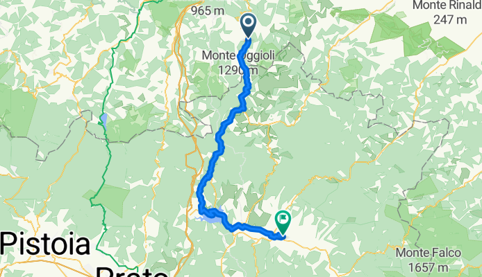
Umbria 2013 2. giorno Loiano- Borgo S. Lorenzo
A cycling route starting in Monghidoro, Emilia-Romagna, Italy.
Overview
About this route
da Loiano a Borgo. San Lorenzo
B&B Il Giardino di Rosi, 51€ senza colazione, umido Colazione alla Casa del Prosciutto a Vicchio Nel pomeriggio visita a Scarpiera ("Borghi più belli d'Italia")- -:--
- Duration
- 58.8 km
- Distance
- 439 m
- Ascent
- 1,052 m
- Descent
- ---
- Avg. speed
- ---
- Max. altitude

Route quality
Waytypes & surfaces along the route
Waytypes
Quiet road
4.7 km
(8 %)
Track
4.7 km
(8 %)
Surfaces
Paved
46.4 km
(79 %)
Unpaved
0.6 km
(1 %)
Asphalt
44.1 km
(75 %)
Paved (undefined)
2.4 km
(4 %)
Continue with Bikemap
Use, edit, or download this cycling route
You would like to ride Umbria 2013 2. giorno Loiano- Borgo S. Lorenzo or customize it for your own trip? Here is what you can do with this Bikemap route:
Free features
- Save this route as favorite or in collections
- Copy & plan your own version of this route
- Sync your route with Garmin or Wahoo
Premium features
Free trial for 3 days, or one-time payment. More about Bikemap Premium.
- Navigate this route on iOS & Android
- Export a GPX / KML file of this route
- Create your custom printout (try it for free)
- Download this route for offline navigation
Discover more Premium features.
Get Bikemap PremiumFrom our community
Other popular routes starting in Monghidoro
 Do San Lazzaro
- Distance
- 44.7 km
- Ascent
- 124 m
- Descent
- 941 m
- Location
- Monghidoro, Emilia-Romagna, Italy
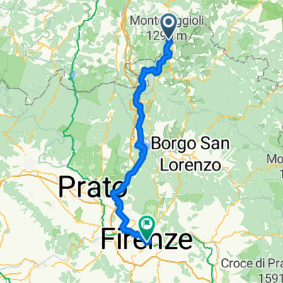 Von Monghidoro bis Florenz
- Distance
- 83.1 km
- Ascent
- 2,156 m
- Descent
- 2,925 m
- Location
- Monghidoro, Emilia-Romagna, Italy
 Rom 9. Tag
- Distance
- 82.3 km
- Ascent
- 485 m
- Descent
- 1,225 m
- Location
- Monghidoro, Emilia-Romagna, Italy
 24 - Flaminia Minor
- Distance
- 76.5 km
- Ascent
- 1,361 m
- Descent
- 1,374 m
- Location
- Monghidoro, Emilia-Romagna, Italy
 Anello alpe di monghidoro
- Distance
- 9.2 km
- Ascent
- 492 m
- Descent
- 486 m
- Location
- Monghidoro, Emilia-Romagna, Italy
 Umbria 2013 2. giorno Loiano- Borgo S. Lorenzo
- Distance
- 58.8 km
- Ascent
- 439 m
- Descent
- 1,052 m
- Location
- Monghidoro, Emilia-Romagna, Italy
 Anellino Monte Beni/Monte Freddi
- Distance
- 7.8 km
- Ascent
- 407 m
- Descent
- 404 m
- Location
- Monghidoro, Emilia-Romagna, Italy
 Tour veloce in
- Distance
- 34.2 km
- Ascent
- 240 m
- Descent
- 776 m
- Location
- Monghidoro, Emilia-Romagna, Italy
Open it in the app