

Gronau - xxx - Gronau
A cycling route starting in Oberstenfeld, Baden-Wurttemberg, Germany.
Overview
About this route
Gronau, Murrhardt, Fichtenberg, Wüstenrot, Prevorst, Gronau
- -:--
- Duration
- 99.3 km
- Distance
- 1,104 m
- Ascent
- 1,103 m
- Descent
- ---
- Avg. speed
- ---
- Max. altitude
Route quality
Waytypes & surfaces along the route
Waytypes
Road
48.7 km
(49 %)
Quiet road
30.8 km
(31 %)
Surfaces
Paved
75.5 km
(76 %)
Unpaved
4 km
(4 %)
Asphalt
72.5 km
(73 %)
Gravel
4 km
(4 %)
Continue with Bikemap
Use, edit, or download this cycling route
You would like to ride Gronau - xxx - Gronau or customize it for your own trip? Here is what you can do with this Bikemap route:
Free features
- Save this route as favorite or in collections
- Copy & plan your own version of this route
- Split it into stages to create a multi-day tour
- Sync your route with Garmin or Wahoo
Premium features
Free trial for 3 days, or one-time payment. More about Bikemap Premium.
- Navigate this route on iOS & Android
- Export a GPX / KML file of this route
- Create your custom printout (try it for free)
- Download this route for offline navigation
Discover more Premium features.
Get Bikemap PremiumFrom our community
Other popular routes starting in Oberstenfeld
 Entlang des Neckars, über Felder zurück
- Distance
- 79.5 km
- Ascent
- 485 m
- Descent
- 486 m
- Location
- Oberstenfeld, Baden-Wurttemberg, Germany
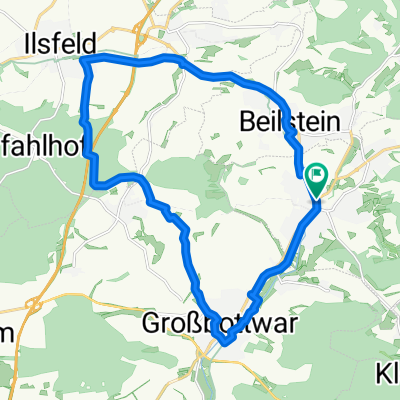 Ilsfeld - Wunnenstein - Großbottwar
- Distance
- 20.3 km
- Ascent
- 178 m
- Descent
- 178 m
- Location
- Oberstenfeld, Baden-Wurttemberg, Germany
 Gronau zum Breitenauer See
- Distance
- 17.9 km
- Ascent
- 205 m
- Descent
- 218 m
- Location
- Oberstenfeld, Baden-Wurttemberg, Germany
 Oberstenfeld in die Spiegelbergrund
- Distance
- 41.8 km
- Ascent
- 697 m
- Descent
- 696 m
- Location
- Oberstenfeld, Baden-Wurttemberg, Germany
 Rute mit anspruchsvoller Steigung und rasanter Abfahrt
- Distance
- 46.2 km
- Ascent
- 824 m
- Descent
- 811 m
- Location
- Oberstenfeld, Baden-Wurttemberg, Germany
 Oberstenfeld Sinzenburg
- Distance
- 23.2 km
- Ascent
- 400 m
- Descent
- 400 m
- Location
- Oberstenfeld, Baden-Wurttemberg, Germany
 Gronau - xxx - Gronau
- Distance
- 99.3 km
- Ascent
- 1,104 m
- Descent
- 1,103 m
- Location
- Oberstenfeld, Baden-Wurttemberg, Germany
 Radrunde um Oberstenfeld
- Distance
- 42.8 km
- Ascent
- 831 m
- Descent
- 830 m
- Location
- Oberstenfeld, Baden-Wurttemberg, Germany
Open it in the app