Pętelka przez Wilczyn i Uraz
A cycling route starting in Oborniki Śląskie, Lower Silesian Voivodeship, Poland.
Overview
About this route
Trasa na niedzielną wycieczkę bardzo łatwa, idealna na dzień po imprezowej nocy :-)
- -:--
- Duration
- 23.3 km
- Distance
- 62 m
- Ascent
- 62 m
- Descent
- ---
- Avg. speed
- ---
- Avg. speed
Route quality
Waytypes & surfaces along the route
Waytypes
Quiet road
7.6 km
(33 %)
Road
7 km
(30 %)
Surfaces
Paved
12.2 km
(53 %)
Unpaved
5.7 km
(25 %)
Asphalt
10.7 km
(46 %)
Gravel
2.2 km
(10 %)
Route highlights
Points of interest along the route
Point of interest after 2.8 km
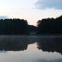
Ośrodek wypoczynkowy Wilczyn
Point of interest after 12 km
Marina w Urazie
Continue with Bikemap
Use, edit, or download this cycling route
You would like to ride Pętelka przez Wilczyn i Uraz or customize it for your own trip? Here is what you can do with this Bikemap route:
Free features
- Save this route as favorite or in collections
- Copy & plan your own version of this route
- Sync your route with Garmin or Wahoo
Premium features
Free trial for 3 days, or one-time payment. More about Bikemap Premium.
- Navigate this route on iOS & Android
- Export a GPX / KML file of this route
- Create your custom printout (try it for free)
- Download this route for offline navigation
Discover more Premium features.
Get Bikemap PremiumFrom our community
Other popular routes starting in Oborniki Śląskie
- Pętelka przez Wilczyn i Uraz
- Distance
- 23.3 km
- Ascent
- 62 m
- Descent
- 62 m
- Location
- Oborniki Śląskie, Lower Silesian Voivodeship, Poland
- Wycieczka nr 5.
- Distance
- 10.3 km
- Ascent
- 212 m
- Descent
- 185 m
- Location
- Oborniki Śląskie, Lower Silesian Voivodeship, Poland
- Wieczka nr 3.
- Distance
- 7.5 km
- Ascent
- 194 m
- Descent
- 195 m
- Location
- Oborniki Śląskie, Lower Silesian Voivodeship, Poland
- drogą Stumilowego Lasu
- Distance
- 19.7 km
- Ascent
- 61 m
- Descent
- 60 m
- Location
- Oborniki Śląskie, Lower Silesian Voivodeship, Poland
- Grębocice 2024 (9-10.03)
- Distance
- 162.2 km
- Ascent
- 654 m
- Descent
- 742 m
- Location
- Oborniki Śląskie, Lower Silesian Voivodeship, Poland
- Wycieczka nr 4.
- Distance
- 27 km
- Ascent
- 471 m
- Descent
- 508 m
- Location
- Oborniki Śląskie, Lower Silesian Voivodeship, Poland
- Wycieczka nr 6.
- Distance
- 9.4 km
- Ascent
- 303 m
- Descent
- 293 m
- Location
- Oborniki Śląskie, Lower Silesian Voivodeship, Poland
- Wycieczka nr 8.
- Distance
- 18.4 km
- Ascent
- 355 m
- Descent
- 393 m
- Location
- Oborniki Śląskie, Lower Silesian Voivodeship, Poland
Open it in the app