Tag_2
- 63.4 km
- 1,121 m
- 1,122 m
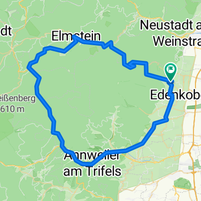
- Sankt Martin, Rhineland-Palatinate, Germany
A cycling route starting in Sankt Martin, Rhineland-Palatinate, Germany.
Overview
We start in St. Martin and roll through Edenkoben - Burrweiler - Albersweiler to Annweiler. From there, we have a few hills until Wilgartswiesen, then an 8 km climb up to Hermersbergerhof, where we reward ourselves with a nice piece of cake at the 'Café Ingrid'. At km 41, we reach the highest point of the route and then enjoy 15 km through the beautiful Frankenweide forest. As steep as the climb was, the descent is equally steep – we let it roll for about 10 km down to Helmbach. Here comes the next challenge – the Todenkopfstraße. It goes towards Kalmit, with sections having a gradient of almost 10%. After about 4 steep kilometers, we reach the turnoff to Kalmitstraße and head back to St. Martin. A very nice tour, which, however, presents a small challenge in places (for us older riders).
created this 12 years ago
Route quality
Road
27.8 km
(35 %)
Quiet road
9.5 km
(12 %)
Paved
69.9 km
(88 %)
Unpaved
1.6 km
(2 %)
Asphalt
69.1 km
(87 %)
Paved (undefined)
0.8 km
(1 %)
Continue with Bikemap
You would like to ride St.Martin - Hermersberger Hof or customize it for your own trip? Here is what you can do with this Bikemap route:
Free trial for 3 days, or one-time payment. More about Bikemap Premium.
Discover more Premium features.
Get Bikemap PremiumFrom our community
Open it in the app