
4. Tag
A cycling route starting in Mens, Auvergne-Rhône-Alpes, France.
Overview
About this route
0
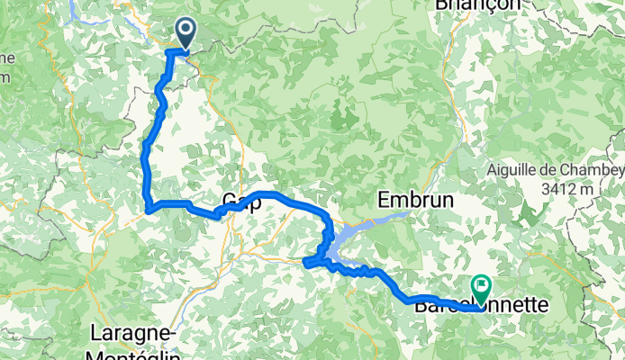
Corps, Bge. du Sautet - Souloise Gorge - Col du Festre - Veynes - Gap - Bge du Serre Ponçon - Barcelonnette
- -:--
- Duration
- 142.2 km
- Distance
- 1,951 m
- Ascent
- 1,766 m
- Descent
- ---
- Avg. speed
- ---
- Max. altitude
Dietrich Haakh
created this 12 years ago
Continue with Bikemap
Use, edit, or download this cycling route
You would like to ride 4. Tag or customize it for your own trip? Here is what you can do with this Bikemap route:
Free features
- Save this route as favorite or in collections
- Copy & plan your own version of this route
- Split it into stages to create a multi-day tour
- Sync your route with Garmin or Wahoo
Premium features
Free trial for 3 days, or one-time payment. More about Bikemap Premium.
- Navigate this route on iOS & Android
- Export a GPX / KML file of this route
- Create your custom printout (try it for free)
- Download this route for offline navigation
Discover more Premium features.
Get Bikemap PremiumFrom our community
Other popular routes starting in Mens
- 4. Etappe Monestier-du-Percy 26220 Dieulefit0
- 104.7 km
- 4,082 m
- 4,702 m
- Mens, Auvergne-Rhône-Alpes, France


Open it in the app