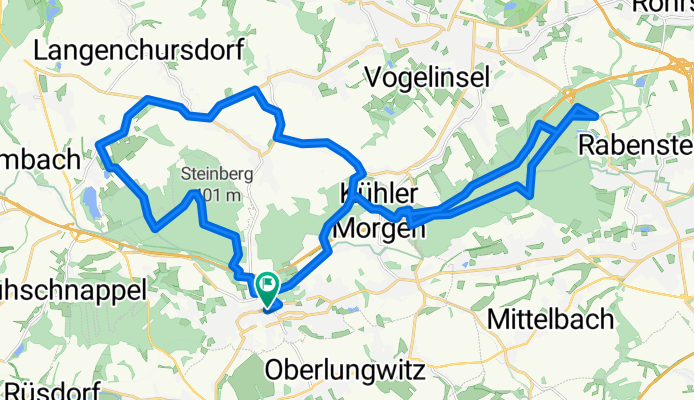

Bahnhofstraße 11, Hohenstein-Ernstthal nach Bahnhofstraße 11, Hohenstein-Ernstthal
- 42.4 km
- 1,122 m
- 1,127 m
- Hohenstein-Ernstthal, Saxony, Germany
A cycling route starting in Hohenstein-Ernstthal, Saxony, Germany.
Overview
To the Oberwald reservoir and Rabenstein reservoir.
created this 12 years ago
Route quality
Track
19.7 km
56 %
Road
3.2 km
9 %
Paved
14.1 km
(40 %)
Unpaved
16.6 km
(47 %)
Asphalt
13 km
37 %
Gravel
9.5 km
27 %
Continue with Bikemap
You would like to ride stauseen runde or customize it for your own trip? Here is what you can do with this Bikemap route:
Free trial for 3 days, or one-time payment. More about Bikemap Premium.
Discover more Premium features.
Get Bikemap PremiumFrom our community
Open it in the app