

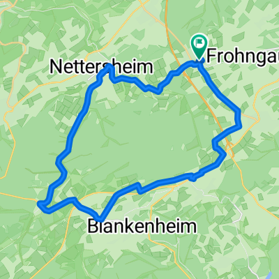
Römerkanalweg Teil 1
A cycling route starting in Nettersheim, North Rhine-Westphalia, Germany.
Overview
About this route
The first stage of the hiking trail along the Roman aqueduct from Nettersheim to Cologne.
- -:--
- Duration
- 64.7 km
- Distance
- 447 m
- Ascent
- 723 m
- Descent
- ---
- Avg. speed
- ---
- Max. altitude

Route quality
Waytypes & surfaces along the route
Waytypes
Track
43.3 km
(67 %)
Quiet road
10.4 km
(16 %)
Surfaces
Paved
23.9 km
(37 %)
Unpaved
31.7 km
(49 %)
Asphalt
19.4 km
(30 %)
Ground
14.2 km
(22 %)
Continue with Bikemap
Use, edit, or download this cycling route
You would like to ride Römerkanalweg Teil 1 or customize it for your own trip? Here is what you can do with this Bikemap route:
Free features
- Save this route as favorite or in collections
- Copy & plan your own version of this route
- Sync your route with Garmin or Wahoo
Premium features
Free trial for 3 days, or one-time payment. More about Bikemap Premium.
- Navigate this route on iOS & Android
- Export a GPX / KML file of this route
- Create your custom printout (try it for free)
- Download this route for offline navigation
Discover more Premium features.
Get Bikemap PremiumFrom our community
Other popular routes starting in Nettersheim
 Nettersheim (die Urft entlang)
- Distance
- 18.6 km
- Ascent
- 193 m
- Descent
- 209 m
- Location
- Nettersheim, North Rhine-Westphalia, Germany
 Erftradweg_V1
- Distance
- 123.1 km
- Ascent
- 84 m
- Descent
- 501 m
- Location
- Nettersheim, North Rhine-Westphalia, Germany
 Erfrunde 2 Tage mit Matamba
- Distance
- 96.8 km
- Ascent
- 178 m
- Descent
- 530 m
- Location
- Nettersheim, North Rhine-Westphalia, Germany
 Kakushöhle (Dreimühlen)
- Distance
- 58.4 km
- Ascent
- 228 m
- Descent
- 549 m
- Location
- Nettersheim, North Rhine-Westphalia, Germany
 Kleine Hausrunde
- Distance
- 28 km
- Ascent
- 318 m
- Descent
- 318 m
- Location
- Nettersheim, North Rhine-Westphalia, Germany
 Engelgau, Blankenheim, Bl.-Wald, Nettersheim, Engelgau
- Distance
- 25.9 km
- Ascent
- 156 m
- Descent
- 167 m
- Location
- Nettersheim, North Rhine-Westphalia, Germany
 Rosenthal
- Distance
- 6.4 km
- Ascent
- 145 m
- Descent
- 197 m
- Location
- Nettersheim, North Rhine-Westphalia, Germany
 Eifel Hohenroute
- Distance
- 200.8 km
- Ascent
- 1,434 m
- Descent
- 1,434 m
- Location
- Nettersheim, North Rhine-Westphalia, Germany
Open it in the app