

Od Pałacu do Pałacu
A cycling route starting in Mysłakowice, Lower Silesian Voivodeship, Poland.
Overview
About this route
Od Pałacu do Pałacu
- -:--
- Duration
- 29.9 km
- Distance
- 327 m
- Ascent
- 327 m
- Descent
- ---
- Avg. speed
- ---
- Max. altitude
Route quality
Waytypes & surfaces along the route
Waytypes
Road
17.1 km
(57 %)
Quiet road
6.7 km
(22 %)
Surfaces
Paved
27.4 km
(92 %)
Unpaved
0.3 km
(1 %)
Asphalt
25.8 km
(86 %)
Paved (undefined)
1.6 km
(5 %)
Route highlights
Points of interest along the route
Point of interest after 4.9 km
Pałac Łomnica
Point of interest after 5.5 km
Pałac Wojanów
Point of interest after 7.1 km
Pałac Wojanów ruiny
Point of interest after 16.8 km
Schronisko Szwajcarka 520m.n.p.m.
Point of interest after 20.2 km
Zamek w Karpnikach
Point of interest after 29 km
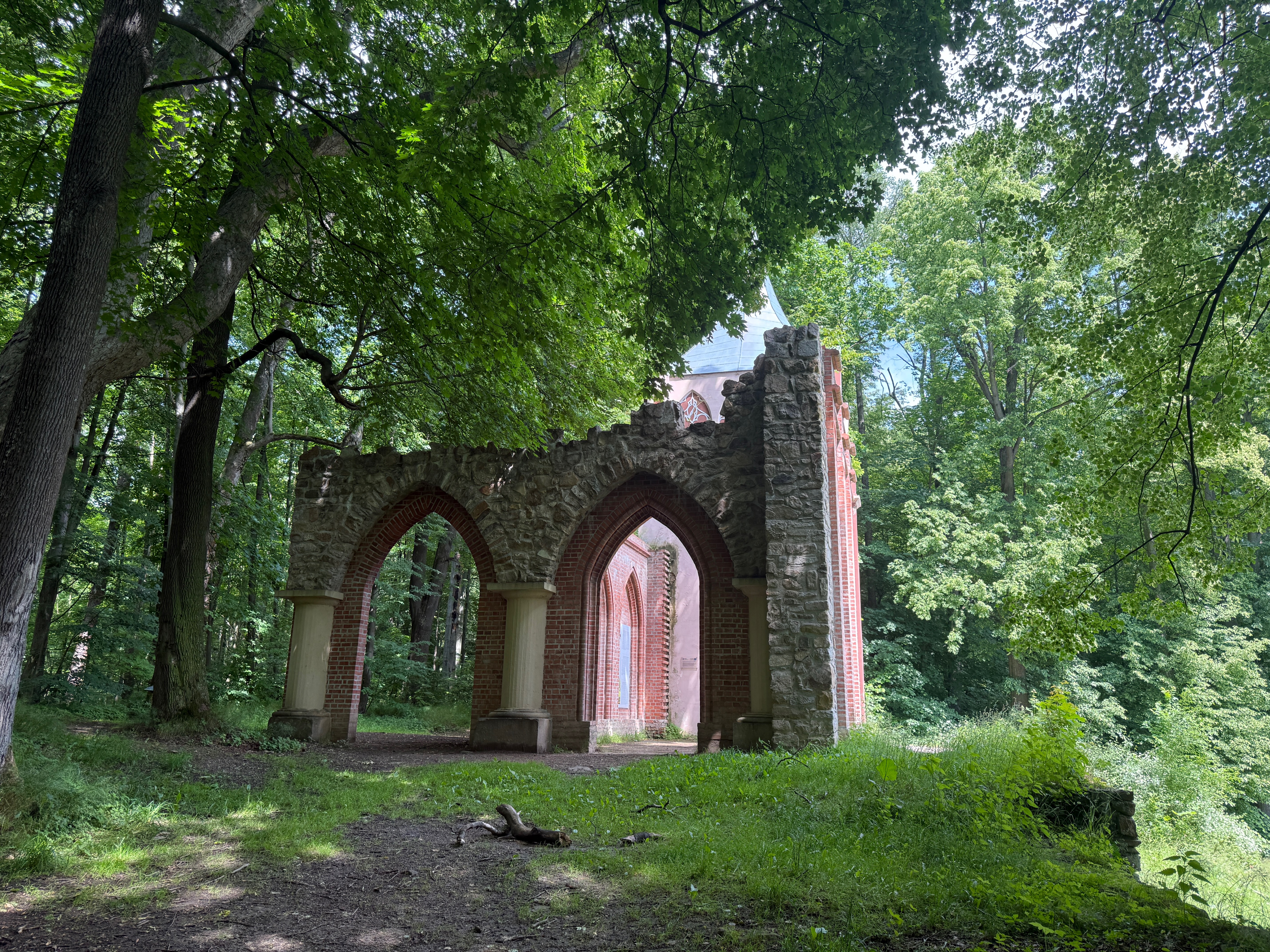
Kościół z antycznymi kolumnami
Point of interest after 29.1 km
Pałac Mysłakowice - szkoła
Continue with Bikemap
Use, edit, or download this cycling route
You would like to ride Od Pałacu do Pałacu or customize it for your own trip? Here is what you can do with this Bikemap route:
Free features
- Save this route as favorite or in collections
- Copy & plan your own version of this route
- Sync your route with Garmin or Wahoo
Premium features
Free trial for 3 days, or one-time payment. More about Bikemap Premium.
- Navigate this route on iOS & Android
- Export a GPX / KML file of this route
- Create your custom printout (try it for free)
- Download this route for offline navigation
Discover more Premium features.
Get Bikemap PremiumFrom our community
Other popular routes starting in Mysłakowice
 DPIO 3 Zachód
- Distance
- 60 km
- Ascent
- 594 m
- Descent
- 596 m
- Location
- Mysłakowice, Lower Silesian Voivodeship, Poland
 Łomnica do Spacerowa, Łomnica
- Distance
- 18.5 km
- Ascent
- 424 m
- Descent
- 405 m
- Location
- Mysłakowice, Lower Silesian Voivodeship, Poland
 Spacer do jeziora Balaton z górą Witosza po drodze
- Distance
- 7.6 km
- Ascent
- 144 m
- Descent
- 138 m
- Location
- Mysłakowice, Lower Silesian Voivodeship, Poland
 Hirschberger Tal, Teilstück
- Distance
- 15.6 km
- Ascent
- 142 m
- Descent
- 189 m
- Location
- Mysłakowice, Lower Silesian Voivodeship, Poland
 dookołasniezki
- Distance
- 107.7 km
- Ascent
- 1,730 m
- Descent
- 1,733 m
- Location
- Mysłakowice, Lower Silesian Voivodeship, Poland
 Od Pałacu do Pałacu
- Distance
- 29.9 km
- Ascent
- 327 m
- Descent
- 327 m
- Location
- Mysłakowice, Lower Silesian Voivodeship, Poland
 DPIO 4 Wschód
- Distance
- 55.5 km
- Ascent
- 1,010 m
- Descent
- 1,013 m
- Location
- Mysłakowice, Lower Silesian Voivodeship, Poland
 Bobrow janowice
- Distance
- 19.4 km
- Ascent
- 212 m
- Descent
- 212 m
- Location
- Mysłakowice, Lower Silesian Voivodeship, Poland
Open it in the app