Sportlich-Sehenswert
- 125.8 km
- 779 m
- 777 m
- Lage, North Rhine-Westphalia, Germany
A cycling route starting in Lage, North Rhine-Westphalia, Germany.
Overview
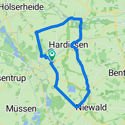
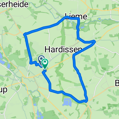
From Lippisches Lage via Detmold, Horn Bad Meinberg towards Schieder Reservoir. Passing by there towards Lügde Bad Pyrmont. In Hämelschenburg, a castle visit is recommended. Otherwise, the route continues towards Aerzen, Groß Berkel into the Extertal valley. Via Bösingfeld and Barntrup, the return journey begins. By this point, approximately 90 - 100 kilometers have been covered. Through Brokhausen and Detmold, the starting point Lage is reached again.
created this 16 years ago
Route quality
Path
49 km
(39 %)
Quiet road
13.8 km
(11 %)
Paved
105.6 km
(84 %)
Unpaved
1.3 km
(1 %)
Asphalt
104.4 km
(83 %)
Paved (undefined)
1.3 km
(1 %)
Route highlights

Continue with Bikemap
You would like to ride Sportlich-Sehenswert or customize it for your own trip? Here is what you can do with this Bikemap route:
Free trial for 3 days, or one-time payment. More about Bikemap Premium.
Discover more Premium features.
Get Bikemap PremiumFrom our community
Open it in the app