

Bad Kleinkirchheim-Turracher Höh
A cycling route starting in Kleinkirchheim, Carinthia, Austria.
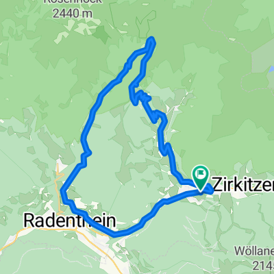
Overview
About this route
Schön steil
- -:--
- Duration
- 37.2 km
- Distance
- 936 m
- Ascent
- 907 m
- Descent
- ---
- Avg. speed
- ---
- Max. altitude
Route quality
Waytypes & surfaces along the route
Waytypes
Busy road
34.8 km
(94 %)
Cycleway
1.4 km
(4 %)
Surfaces
Paved
36.7 km
(99 %)
Asphalt
36.5 km
(98 %)
Paved (undefined)
0.1 km
(<1 %)
Undefined
0.5 km
(1 %)
Continue with Bikemap
Use, edit, or download this cycling route
You would like to ride Bad Kleinkirchheim-Turracher Höh or customize it for your own trip? Here is what you can do with this Bikemap route:
Free features
- Save this route as favorite or in collections
- Copy & plan your own version of this route
- Sync your route with Garmin or Wahoo
Premium features
Free trial for 3 days, or one-time payment. More about Bikemap Premium.
- Navigate this route on iOS & Android
- Export a GPX / KML file of this route
- Create your custom printout (try it for free)
- Download this route for offline navigation
Discover more Premium features.
Get Bikemap PremiumFrom our community
Other popular routes starting in Kleinkirchheim
 Bad Kleinkirchheim Runde
- Distance
- 34.4 km
- Ascent
- 1,126 m
- Descent
- 1,148 m
- Location
- Kleinkirchheim, Carinthia, Austria
 Rund-um-den-Kolmnock
- Distance
- 23.7 km
- Ascent
- 1,032 m
- Descent
- 1,032 m
- Location
- Kleinkirchheim, Carinthia, Austria
 Gurkursprung-Tour
- Distance
- 27.8 km
- Ascent
- 1,030 m
- Descent
- 1,030 m
- Location
- Kleinkirchheim, Carinthia, Austria
 Nockalmstrasse-Bad Kleinkircheim
- Distance
- 105.4 km
- Ascent
- 2,030 m
- Descent
- 2,030 m
- Location
- Kleinkirchheim, Carinthia, Austria
 Patergassen - Nockalmstraße - Turrach - St.Lorenzen - Patergassen
- Distance
- 50.2 km
- Ascent
- 1,171 m
- Descent
- 1,171 m
- Location
- Kleinkirchheim, Carinthia, Austria
 Alpe-Adria Trail 2-7
- Distance
- 14.4 km
- Ascent
- 1,066 m
- Descent
- 1,193 m
- Location
- Kleinkirchheim, Carinthia, Austria
 14 st oswald
- Distance
- 32.1 km
- Ascent
- 1,068 m
- Descent
- 1,067 m
- Location
- Kleinkirchheim, Carinthia, Austria
 Genußrunde BKK
- Distance
- 28.7 km
- Ascent
- 1,986 m
- Descent
- 1,980 m
- Location
- Kleinkirchheim, Carinthia, Austria
Open it in the app