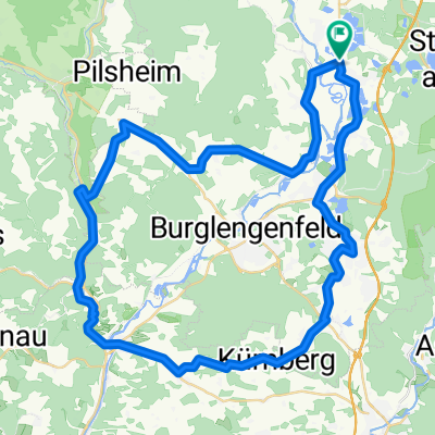
Tour nach Bad Abbach endlang der Donau
A cycling route starting in Schwandorf in Bayern, Bavaria, Germany.
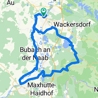
Overview
About this route
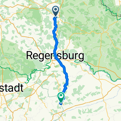
There is something cool and worth seeing to cycle along the Danube
- -:--
- Duration
- 89.4 km
- Distance
- 1,045 m
- Ascent
- 1,045 m
- Descent
- ---
- Avg. speed
- ---
- Max. altitude
Continue with Bikemap
Use, edit, or download this cycling route
You would like to ride Tour nach Bad Abbach endlang der Donau or customize it for your own trip? Here is what you can do with this Bikemap route:
Free features
- Save this route as favorite or in collections
- Copy & plan your own version of this route
- Split it into stages to create a multi-day tour
- Sync your route with Garmin or Wahoo
Premium features
Free trial for 3 days, or one-time payment. More about Bikemap Premium.
- Navigate this route on iOS & Android
- Export a GPX / KML file of this route
- Create your custom printout (try it for free)
- Download this route for offline navigation
Discover more Premium features.
Get Bikemap PremiumFrom our community
Other popular routes starting in Schwandorf in Bayern
 Regensburg - Deggendorf Regensburg - Deggendorf- Distance
- 201.5 km
- Ascent
- 823 m
- Descent
- 858 m
- Location
- Schwandorf in Bayern, Bavaria, Germany
 
 Kallmünz übers Vilstal Kallmünz übers Vilstal- Distance
- 57.9 km
- Ascent
- 330 m
- Descent
- 333 m
- Location
- Schwandorf in Bayern, Bavaria, Germany
 
 Rund um Naabeck Rund um Naabeck- Distance
- 18.7 km
- Ascent
- 159 m
- Descent
- 159 m
- Location
- Schwandorf in Bayern, Bavaria, Germany
 
 Bahnhof/ZOB nach Bahnhof/ZOB Bahnhof/ZOB nach Bahnhof/ZOB- Distance
- 58.5 km
- Ascent
- 177 m
- Descent
- 178 m
- Location
- Schwandorf in Bayern, Bavaria, Germany
 
 Tour nach Bad Abbach endlang der Donau Tour nach Bad Abbach endlang der Donau- Distance
- 89.4 km
- Ascent
- 1,045 m
- Descent
- 1,045 m
- Location
- Schwandorf in Bayern, Bavaria, Germany
 
 Saale 4 kurz: Schwandorf - Kotzenbach, Gasthaus Mois, 70,5km, 271hm Saale 4 kurz: Schwandorf - Kotzenbach, Gasthaus Mois, 70,5km, 271hm- Distance
- 70.8 km
- Ascent
- 230 m
- Descent
- 183 m
- Location
- Schwandorf in Bayern, Bavaria, Germany
 
 Otto-Hahn-Straße nach Naabgasse Otto-Hahn-Straße nach Naabgasse- Distance
- 16.2 km
- Ascent
- 93 m
- Descent
- 124 m
- Location
- Schwandorf in Bayern, Bavaria, Germany
 
 Schwandorf Piestelwies Schwandorf Schwandorf Piestelwies Schwandorf- Distance
- 30.3 km
- Ascent
- 219 m
- Descent
- 223 m
- Location
- Schwandorf in Bayern, Bavaria, Germany
 
Open it in the app


