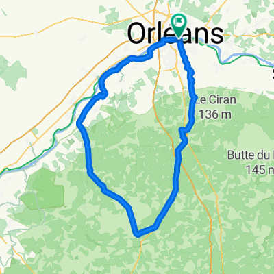
LOIRET - S - 96KM - st privé-dry-moncay-lailly-huisseau-chaingy
- 95.4 km
- 298 m
- 297 m
- Saint-Jean-le-Blanc, Centre-Val de Loire, France
A cycling route starting in Saint-Jean-le-Blanc, Centre-Val de Loire, France.
Overview
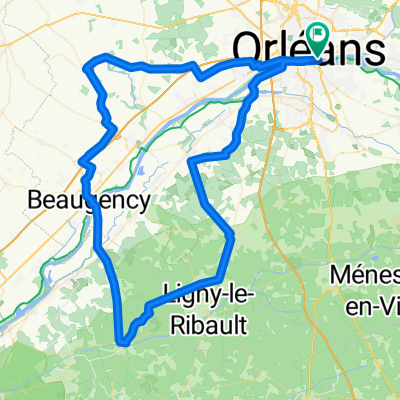
Southwest Orleans----110 kms----- Semoy - Chanteau - Les Chapelles - Chevilly - Huêtre - Bricy - Coinces (cemetery break at km37) - St Péravy - St Sigismond - Gémigny - Rozière - Coulmiers - Baccon - Cravant - Villorceau - Beaugency - head towards Lailly - Dry - Pont de Meung - head towards Cléry - return along the levee -
created this 11 years ago
Route quality
Road
47.2 km
(43 %)
Quiet road
30.8 km
(28 %)
Paved
47.2 km
(43 %)
Asphalt
47.2 km
(43 %)
Undefined
62.6 km
(57 %)
Route highlights
¨PAUSE KM 37 cimetière de Coinces
Continue with Bikemap
You would like to ride LOIRET SO -110KM saran - gidy - beaugency or customize it for your own trip? Here is what you can do with this Bikemap route:
Free trial for 3 days, or one-time payment. More about Bikemap Premium.
Discover more Premium features.
Get Bikemap PremiumFrom our community
Open it in the app