
Rhone-Alpes: Etappe 6
A cycling route starting in Montmélian, Auvergne-Rhône-Alpes, France.
Overview
About this route
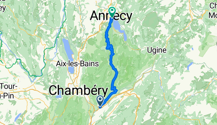
Start: Montmélian
- Col du Frene - Col de Leschaux - Crêt de Châtillon Ende: Annecy- -:--
- Duration
- 79.2 km
- Distance
- 1,700 m
- Ascent
- 1,524 m
- Descent
- ---
- Avg. speed
- ---
- Max. altitude
Route quality
Waytypes & surfaces along the route
Waytypes
Busy road
65.4 km
(83 %)
Road
10.9 km
(14 %)
Surfaces
Paved
70.7 km
(89 %)
Asphalt
70.7 km
(89 %)
Undefined
8.5 km
(11 %)
Route highlights
Points of interest along the route

Point of interest after 21.3 km
Col du Frene, 950m

Point of interest after 48.7 km
Col de Leschaux, 900m Auffahrt zum Crêt de Châtillon

Point of interest after 49 km
Brotzeit

Point of interest after 61.4 km
Crêt de Chatillon, 1670m
Continue with Bikemap
Use, edit, or download this cycling route
You would like to ride Rhone-Alpes: Etappe 6 or customize it for your own trip? Here is what you can do with this Bikemap route:
Free features
- Save this route as favorite or in collections
- Copy & plan your own version of this route
- Sync your route with Garmin or Wahoo
Premium features
Free trial for 3 days, or one-time payment. More about Bikemap Premium.
- Navigate this route on iOS & Android
- Export a GPX / KML file of this route
- Create your custom printout (try it for free)
- Download this route for offline navigation
Discover more Premium features.
Get Bikemap PremiumFrom our community
Other popular routes starting in Montmélian
 220805_j12_Arbin_StJeoire_colMarocaz_Cruet_Arbin
- Distance
- 35.4 km
- Ascent
- 872 m
- Descent
- 870 m
- Location
- Montmélian, Auvergne-Rhône-Alpes, France
 Tour des Bauges
- Distance
- 147.5 km
- Ascent
- 1,872 m
- Descent
- 1,872 m
- Location
- Montmélian, Auvergne-Rhône-Alpes, France
 Col de Champ-Laurent
- Distance
- 62.8 km
- Ascent
- 1,259 m
- Descent
- 1,259 m
- Location
- Montmélian, Auvergne-Rhône-Alpes, France
 Momtélian - gières
- Distance
- 74.7 km
- Ascent
- 1,335 m
- Descent
- 1,193 m
- Location
- Montmélian, Auvergne-Rhône-Alpes, France
 2208_test_Bauges
- Distance
- 94 km
- Ascent
- 1,377 m
- Descent
- 1,364 m
- Location
- Montmélian, Auvergne-Rhône-Alpes, France
 traversée chartreuse
- Distance
- 83.8 km
- Ascent
- 1,942 m
- Descent
- 2,023 m
- Location
- Montmélian, Auvergne-Rhône-Alpes, France
 1988 - Tour de France - 04. Tag - Montmélian - Grenoble
- Distance
- 70 km
- Ascent
- 243 m
- Descent
- 376 m
- Location
- Montmélian, Auvergne-Rhône-Alpes, France
 Rhone-Alpes: Etappe 6
- Distance
- 79.2 km
- Ascent
- 1,700 m
- Descent
- 1,524 m
- Location
- Montmélian, Auvergne-Rhône-Alpes, France
Open it in the app