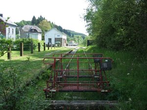
Kalltall-Route
A cycling route starting in Monschau, North Rhine-Westphalia, Germany.
Overview
About this route
Kalltall
- -:--
- Duration
- 57.7 km
- Distance
- 113 m
- Ascent
- 496 m
- Descent
- ---
- Avg. speed
- ---
- Max. altitude
Route highlights
Points of interest along the route

Point of interest after 0 km
Kalterherberg,Bahnhof

Point of interest after 6.5 km
Bhf. Monschau

Point of interest after 10.2 km
Venn-Bahn Fahrradweg

Point of interest after 17.9 km
Kalltal-Sperre

Point of interest after 21.5 km
Hürtgenwald bei Simonskall

Point of interest after 24.1 km
Cafe Kern & mehr, Simonskall 25, 52393 Huertgenwald Tel.: (0 24 29) - 24 85

Point of interest after 28.6 km
Die Kall

Point of interest after 34.1 km
Im Kalltal

Point of interest after 37.6 km
Brücke Rurtalbahn an die Mündung der Kall

Point of interest after 42.5 km
Restaurant Strepp am See Am Stausee Kreuzau - Obermaubach NRW Germany 52372 Telefon: +49 (0) 24 22 / 74 5 Samstag bis Sonntag ab 10:00 Uhr geöffne

Point of interest after 52.8 km
Lendersdorfer Wehr
Continue with Bikemap
Use, edit, or download this cycling route
You would like to ride Kalltall-Route or customize it for your own trip? Here is what you can do with this Bikemap route:
Free features
- Save this route as favorite or in collections
- Copy & plan your own version of this route
- Sync your route with Garmin or Wahoo
Premium features
Free trial for 3 days, or one-time payment. More about Bikemap Premium.
- Navigate this route on iOS & Android
- Export a GPX / KML file of this route
- Create your custom printout (try it for free)
- Download this route for offline navigation
Discover more Premium features.
Get Bikemap PremiumFrom our community
Other popular routes starting in Monschau
 Vennbahn Day 5 , Monschau to Eupen, via Wesertalsperre
- Distance
- 43.4 km
- Ascent
- 487 m
- Descent
- 623 m
- Location
- Monschau, North Rhine-Westphalia, Germany
 Rondje stuwmeer 100km
- Distance
- 101.6 km
- Ascent
- 1,262 m
- Descent
- 1,262 m
- Location
- Monschau, North Rhine-Westphalia, Germany
 Volg de Rur
- Distance
- 18.1 km
- Ascent
- 271 m
- Descent
- 271 m
- Location
- Monschau, North Rhine-Westphalia, Germany
 Monschau Rundfahrt 2_17 27km
- Distance
- 27 km
- Ascent
- 366 m
- Descent
- 402 m
- Location
- Monschau, North Rhine-Westphalia, Germany
 Dreier Singletrail - bist platt danach
- Distance
- 6.1 km
- Ascent
- 283 m
- Descent
- 270 m
- Location
- Monschau, North Rhine-Westphalia, Germany
 Rurseerunde
- Distance
- 43.8 km
- Ascent
- 697 m
- Descent
- 695 m
- Location
- Monschau, North Rhine-Westphalia, Germany
 Tour im Hohen Venn 20.8.16
- Distance
- 47.1 km
- Ascent
- 368 m
- Descent
- 368 m
- Location
- Monschau, North Rhine-Westphalia, Germany
 Vennbahn - Day 3 - Loop 3 - Das Hohe Venn im Hertogenwald
- Distance
- 34.7 km
- Ascent
- 430 m
- Descent
- 430 m
- Location
- Monschau, North Rhine-Westphalia, Germany
Open it in the app


