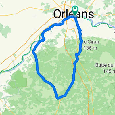
LOIRET - S - 96KM - st privé-dry-moncay-lailly-huisseau-chaingy
A cycling route starting in Saint-Jean-le-Blanc, Centre-Val de Loire, France.
Overview
About this route
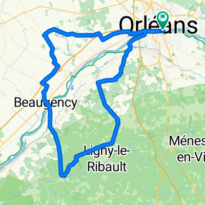
sud ouest orleans----96kms----pont Thinat-st privé-pont de meung-cléry - dir jouy-la californie- moncay(pause km42 Monçay)-lailly--dry-meung-circuit des mauves-huisseau-chaingy- la chapelle-simply
- -:--
- Duration
- 95.4 km
- Distance
- 298 m
- Ascent
- 297 m
- Descent
- ---
- Avg. speed
- 122 m
- Max. altitude
Route quality
Waytypes & surfaces along the route
Waytypes
- Quiet road - 38.2 km - (40 %) 
- Road - 16.2 km - (17 %) 
Surfaces
Paved
33.4 km
(35 %)
Unpaved
1 km
(1 %)
- Asphalt - 32.4 km - (34 %) 
- Concrete - 1 km - (1 %) 
Route highlights
Points of interest along the route
- Drinking water after 48.2 km- pause technique 46,5ème km 
Continue with Bikemap
Use, edit, or download this cycling route
You would like to ride LOIRET - S - 96KM - st privé-dry-moncay-lailly-huisseau-chaingy or customize it for your own trip? Here is what you can do with this Bikemap route:
Free features
- Save this route as favorite or in collections
- Copy & plan your own version of this route
- Split it into stages to create a multi-day tour
- Sync your route with Garmin or Wahoo
Premium features
Free trial for 3 days, or one-time payment. More about Bikemap Premium.
- Navigate this route on iOS & Android
- Export a GPX / KML file of this route
- Create your custom printout (try it for free)
- Download this route for offline navigation
Discover more Premium features.
Get Bikemap PremiumFrom our community
Other popular routes starting in Saint-Jean-le-Blanc
 LOIRET - SUD - 109km LOIRET - SUD - 109km- Distance
- 109.1 km
- Ascent
- 332 m
- Descent
- 328 m
- Location
- Saint-Jean-le-Blanc, Centre-Val de Loire, France
 
 LOIRET SO -110KM saran - gidy - beaugency LOIRET SO -110KM saran - gidy - beaugency- Distance
- 109.8 km
- Ascent
- 262 m
- Descent
- 259 m
- Location
- Saint-Jean-le-Blanc, Centre-Val de Loire, France
 
 LOIRET -SO - 103KM LOIRET -SO - 103KM- Distance
- 103.1 km
- Ascent
- 280 m
- Descent
- 278 m
- Location
- Saint-Jean-le-Blanc, Centre-Val de Loire, France
 
 LOIRET - N-EST-84km LOIRET - N-EST-84km- Distance
- 83.4 km
- Ascent
- 352 m
- Descent
- 351 m
- Location
- Saint-Jean-le-Blanc, Centre-Val de Loire, France
 
 LOIRET - SUD - 92 kms LOIRET - SUD - 92 kms- Distance
- 92.2 km
- Ascent
- 287 m
- Descent
- 288 m
- Location
- Saint-Jean-le-Blanc, Centre-Val de Loire, France
 
 LOIRET NE - 111 KMS - étang de la vallée- chambon LOIRET NE - 111 KMS - étang de la vallée- chambon- Distance
- 111.5 km
- Ascent
- 157 m
- Descent
- 157 m
- Location
- Saint-Jean-le-Blanc, Centre-Val de Loire, France
 
 LOIRET - S - 96KM - st privé-dry-moncay-lailly-huisseau-chaingy LOIRET - S - 96KM - st privé-dry-moncay-lailly-huisseau-chaingy- Distance
- 95.4 km
- Ascent
- 298 m
- Descent
- 297 m
- Location
- Saint-Jean-le-Blanc, Centre-Val de Loire, France
 
 LOIRET - SE -91km LOIRET - SE -91km- Distance
- 91.1 km
- Ascent
- 356 m
- Descent
- 353 m
- Location
- Saint-Jean-le-Blanc, Centre-Val de Loire, France
 
Open it in the app


