

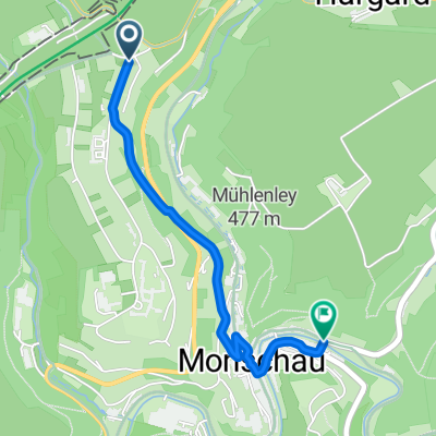
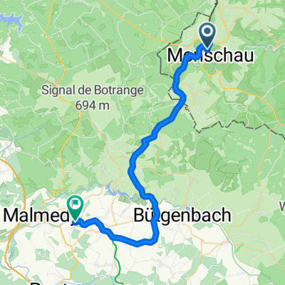
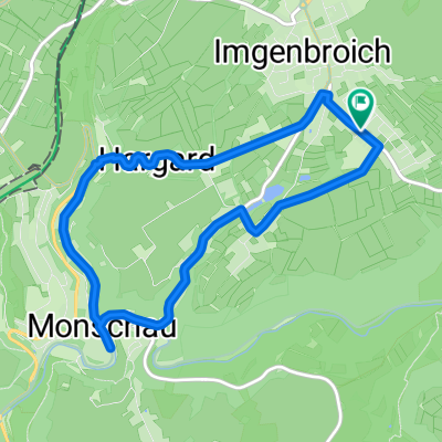
Vennquerbahn-Radweg
A cycling route starting in Monschau, North Rhine-Westphalia, Germany.
Overview
About this route
Die ehemalige Vennquerbahn verläuft von Jünkerath über Stadtkyll, Hallschlag und Losheim nach Belgien, wo sie in Weywertz auf die Vennbahn trifft.
Eröffnet wurde die Bahnstrecke am 01.07.1912 und wurde hauptsächliche für militärische Zwecke genutzt
- -:--
- Duration
- 53.2 km
- Distance
- 284 m
- Ascent
- 359 m
- Descent
- ---
- Avg. speed
- ---
- Max. altitude

Route quality
Waytypes & surfaces along the route
Waytypes
Cycleway
31.9 km
(60 %)
Path
8.5 km
(16 %)
Surfaces
Paved
50.5 km
(95 %)
Unpaved
0.5 km
(1 %)
Asphalt
46.8 km
(88 %)
Paved (undefined)
3.7 km
(7 %)
Continue with Bikemap
Use, edit, or download this cycling route
You would like to ride Vennquerbahn-Radweg or customize it for your own trip? Here is what you can do with this Bikemap route:
Free features
- Save this route as favorite or in collections
- Copy & plan your own version of this route
- Sync your route with Garmin or Wahoo
Premium features
Free trial for 3 days, or one-time payment. More about Bikemap Premium.
- Navigate this route on iOS & Android
- Export a GPX / KML file of this route
- Create your custom printout (try it for free)
- Download this route for offline navigation
Discover more Premium features.
Get Bikemap PremiumFrom our community
Other popular routes starting in Monschau
 VB Loop W High Fens, Monschau
- Distance
- 39.7 km
- Ascent
- 662 m
- Descent
- 659 m
- Location
- Monschau, North Rhine-Westphalia, Germany
 Vichtbachtal Hohes-Venn
- Distance
- 55.6 km
- Ascent
- 259 m
- Descent
- 592 m
- Location
- Monschau, North Rhine-Westphalia, Germany
 Hilgershof nach Eschbachstraße
- Distance
- 2.1 km
- Ascent
- 18 m
- Descent
- 119 m
- Location
- Monschau, North Rhine-Westphalia, Germany
 VB 3 - Monschau (D) - Arimont (B, Waimes) 34 km
- Distance
- 33.6 km
- Ascent
- 386 m
- Descent
- 363 m
- Location
- Monschau, North Rhine-Westphalia, Germany
 Monschau Venn
- Distance
- 57.6 km
- Ascent
- 649 m
- Descent
- 666 m
- Location
- Monschau, North Rhine-Westphalia, Germany
 Grünentalstraße nach Grünentalstraße
- Distance
- 7.8 km
- Ascent
- 152 m
- Descent
- 151 m
- Location
- Monschau, North Rhine-Westphalia, Germany
 Kalltall-Route
- Distance
- 57.7 km
- Ascent
- 113 m
- Descent
- 496 m
- Location
- Monschau, North Rhine-Westphalia, Germany
 Monschau Rundfahrt 2_17 27km
- Distance
- 27 km
- Ascent
- 366 m
- Descent
- 402 m
- Location
- Monschau, North Rhine-Westphalia, Germany
Open it in the app