

Výlet do Modré
A cycling route starting in Otaslavice, Olomoucký kraj, Czechia.
Overview
About this route
Archeoskanzen Modrá - The Great Moravian settlement in central Pomoraví is located near Uherské Hradiště on the road between Staré Město and Velehrad. It is an important institution that illustrates one of the most significant stages of our national history. The open-air museum lives a daily life with educational presentations, programs, experimental metal casts, pottery production, agricultural production, and ongoing archaeological research.
Velehrad - Originally a Cistercian monastery and one of the most significant pilgrimage sites in Moravia. Built at the beginning of the 13th century in the late Romanesque style. It includes the basilica of the Assumption of the Virgin Mary and Saints Cyril and Methodius. The current appearance of the basilica and monastery dates back to the turn of the 17th and 18th centuries, when an extensive baroque reconstruction began.
Bunč - Forest Guesthouse BUNČ is located in the middle of the northeastern ridge at an altitude of 479 meters above sea level, on the border of the Kroměříž and Uherské Hradiště districts. Here, roads from Zdounek to Modrá via Velehrad to Uherské Hradiště and roads from Zdounek through Bunč to Kostelany and Kvasice intersect. The significance of this location is enhanced by a number of well-marked tourist trails for hiking and cycling tourism across the entire Chřiby mountain range. The uniqueness of this place lies in the fact that here, right in its center, converge the boundaries of five cadasters of the municipalities of Roštín, Kostelan, Salaš, Velehrad, and Jankovice.
- -:--
- Duration
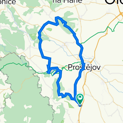
- 113.8 km
- Distance
- 1,283 m
- Ascent
- 1,362 m
- Descent
- ---
- Avg. speed
- 504 m
- Max. altitude

Route quality
Waytypes & surfaces along the route
Waytypes
Road
77.4 km
(68 %)
Track
12.5 km
(11 %)
Surfaces
Paved
45.5 km
(40 %)
Unpaved
1.1 km
(1 %)
Asphalt
45.5 km
(40 %)
Unpaved (undefined)
1.1 km
(1 %)
Undefined
67.1 km
(59 %)
Continue with Bikemap
Use, edit, or download this cycling route
You would like to ride Výlet do Modré or customize it for your own trip? Here is what you can do with this Bikemap route:
Free features
- Save this route as favorite or in collections
- Copy & plan your own version of this route
- Split it into stages to create a multi-day tour
- Sync your route with Garmin or Wahoo
Premium features
Free trial for 3 days, or one-time payment. More about Bikemap Premium.
- Navigate this route on iOS & Android
- Export a GPX / KML file of this route
- Create your custom printout (try it for free)
- Download this route for offline navigation
Discover more Premium features.
Get Bikemap PremiumFrom our community
Other popular routes starting in Otaslavice
 krátký okruh: Myslejovice - Žarovice - Drahany - Myslejovice
- Distance
- 34.2 km
- Ascent
- 548 m
- Descent
- 548 m
- Location
- Otaslavice, Olomoucký kraj, Czechia
 Myslejovice-Jedovnice-Rudice-Adamov-Křtiny-Ruprechtov-Pustiměř-Brodek u Prostějova-Určice-Myslejovice
- Distance
- 120.4 km
- Ascent
- 2,097 m
- Descent
- 2,139 m
- Location
- Otaslavice, Olomoucký kraj, Czechia
 Myslejovice-Podivice-Pustiměř-Ivanovice-Vrchoslavice-Klenovice-Prostějov-Myslejovice
- Distance
- 70.4 km
- Ascent
- 595 m
- Descent
- 577 m
- Location
- Otaslavice, Olomoucký kraj, Czechia
 Vřesovice-Kelčice-Vranovice-Vincencov-Myslejovice-Alojzov-Určice-Dětkovice-Vranovice-Kelčice-Vřesovice
- Distance
- 20.6 km
- Ascent
- 224 m
- Descent
- 221 m
- Location
- Otaslavice, Olomoucký kraj, Czechia
 "Krátká na rozhlednu"
- Distance
- 7.1 km
- Ascent
- 92 m
- Descent
- 92 m
- Location
- Otaslavice, Olomoucký kraj, Czechia
 Vranovická
- Distance
- 29.2 km
- Ascent
- 363 m
- Descent
- 356 m
- Location
- Otaslavice, Olomoucký kraj, Czechia
 Vranovice-Kosíř-Vranovice
- Distance
- 54.8 km
- Ascent
- 569 m
- Descent
- 569 m
- Location
- Otaslavice, Olomoucký kraj, Czechia
 Vranovice-kolem VP-Vranovice
- Distance
- 71 km
- Ascent
- 814 m
- Descent
- 814 m
- Location
- Otaslavice, Olomoucký kraj, Czechia
Open it in the app