

2015 JAN 20-29 個人台灣環島
A cycling route starting in Taipei, Taipei, Taiwan.
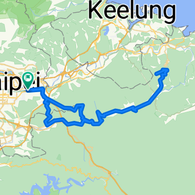
Overview
About this route
2015 JAN 20-29 個人台灣環島
Day 1 - 台北佳遊單車 至 桃園縣 Day 2 - 桃園縣 至 苗粟縣 Day 3 - 苗粟縣 至 雲林縣西螺鎮 Day 4 - 雲林縣西螺鎮 至 台南巿南區 Day 5 - 台南巿南區 至 屏東縣恆春鎮墾丁 Day 6 - 屏東縣恆春鎮墾丁 至 屏東縣牡丹鄉旭海 Day 7 - 屏東縣牡丹鄉旭海 至 台東縣卑南鄉知本 Day 8 - 台東縣卑南鄉龍知本 至 花蓮縣瑞穗鄉 Day 9 - 花蓮縣瑞穗鄉 至 宜蘭縣羅東鎮 Day 10 - 宜蘭縣羅東鎮 至 台北佳遊單車 減去:花蓮火車站 至 羅東火車站 - 90.06 km / 3650 hm 總騎乘距離:938.90 km 總爬升高度:1840 hm 註:不夠時間騎基隆和淡水- -:--
- Duration
- 1,029.1 km
- Distance
- 1,680 m
- Ascent
- 1,680 m
- Descent
- ---
- Avg. speed
- ---
- Max. altitude
Continue with Bikemap
Use, edit, or download this cycling route
You would like to ride 2015 JAN 20-29 個人台灣環島 or customize it for your own trip? Here is what you can do with this Bikemap route:
Free features
- Save this route as favorite or in collections
- Copy & plan your own version of this route
- Split it into stages to create a multi-day tour
- Sync your route with Garmin or Wahoo
Premium features
Free trial for 3 days, or one-time payment. More about Bikemap Premium.
- Navigate this route on iOS & Android
- Export a GPX / KML file of this route
- Create your custom printout (try it for free)
- Download this route for offline navigation
Discover more Premium features.
Get Bikemap PremiumFrom our community
Other popular routes starting in Taipei
 2010/11/02 南港昆陽站到五分山折返 練習路線圖
- Distance
- 87.1 km
- Ascent
- 1,374 m
- Descent
- 1,374 m
- Location
- Taipei, Taipei, Taiwan
 復興南路穿南港南深路轉景美溪回
- Distance
- 44.9 km
- Ascent
- 302 m
- Descent
- 304 m
- Location
- Taipei, Taipei, Taiwan
 Sep.14,10-環大台北練習
- Distance
- 168.3 km
- Ascent
- 703 m
- Descent
- 703 m
- Location
- Taipei, Taipei, Taiwan
 永和-淡水來回
- Distance
- 71.1 km
- Ascent
- 90 m
- Descent
- 81 m
- Location
- Taipei, Taipei, Taiwan
 2015 JAN 20-29 個人台灣環島
- Distance
- 1,029.1 km
- Ascent
- 1,680 m
- Descent
- 1,680 m
- Location
- Taipei, Taipei, Taiwan
 信義河濱-故宮-平等里-冷水坑-二子坪-八拉卡-紅樹林-河濱-公館(O型)
- Distance
- 84.1 km
- Ascent
- 1,319 m
- Descent
- 1,338 m
- Location
- Taipei, Taipei, Taiwan
 三橫一豎+花東海岸線
- Distance
- 1,118.3 km
- Ascent
- 8,871 m
- Descent
- 8,871 m
- Location
- Taipei, Taipei, Taiwan
 中社爬坡路徑
- Distance
- 4.3 km
- Ascent
- 294 m
- Descent
- 54 m
- Location
- Taipei, Taipei, Taiwan
Open it in the app