- 89.4 km
- 1,045 m
- 1,045 m
- Schwandorf in Bayern, Bavaria, Germany
Kallmünz übers Vilstal
A cycling route starting in Schwandorf in Bayern, Bavaria, Germany.
Overview
About this route
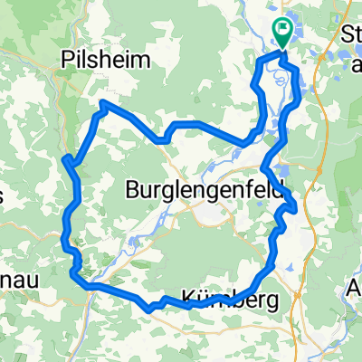
The starting and ending point is the Klardorfer roundabout.
The route initially runs along the western slope of the Naab valley and ascends at Premberg to the foothills of the Oberpfalz Jura. From Pettenhof to Kallmünz, the route follows the Five Rivers cycle path.
The route can also be ridden clockwise, but between St 2165 and Lanzenried, there is a 10% incline over a length of 800 m to overcome.
The route can be taken as a quick tour in the afternoon but is also suitable as a day trip. On a day trip, about 2 hours should be planned for the visit to Kallmünz (noteworthy historical town center). Attention: In Kallmünz, pedestrians often stroll carelessly along the road.
Please use the excellently developed cycle path on the east side of the B 15 starting from Teublitz!
- -:--
- Duration
- 57.9 km
- Distance
- 340 m
- Ascent
- 343 m
- Descent
- ---
- Avg. speed
- ---
- Max. altitude
created this 10 years ago
Route quality
Waytypes & surfaces along the route
Waytypes
Quiet road
21.4 km
(37 %)
Road
11 km
(19 %)
Surfaces
Paved
36.5 km
(63 %)
Unpaved
1.7 km
(3 %)
Asphalt
35.3 km
(61 %)
Concrete
1.2 km
(2 %)
Route highlights
Points of interest along the route
Point of interest after 51.9 km
Von hier bis zum Endpunkt verläuft ein gut ausgebauter Radweg parallel zur Bundesstraße 15. Bitte benutzt ihn auch.
Continue with Bikemap
Use, edit, or download this cycling route
You would like to ride Kallmünz übers Vilstal or customize it for your own trip? Here is what you can do with this Bikemap route:
Free features
- Save this route as favorite or in collections
- Copy & plan your own version of this route
- Sync your route with Garmin or Wahoo
Premium features
Free trial for 3 days, or one-time payment. More about Bikemap Premium.
- Navigate this route on iOS & Android
- Export a GPX / KML file of this route
- Create your custom printout (try it for free)
- Download this route for offline navigation
Discover more Premium features.
Get Bikemap PremiumFrom our community
Other popular routes starting in Schwandorf in Bayern
- Tour nach Bad Abbach endlang der Donau
- Regensburg - Deggendorf
- 200.4 km
- 806 m
- 841 m
- Schwandorf in Bayern, Bavaria, Germany
- ADFC SAD-Schmidmühlen-Ensdorf-SAD 47
- 46.5 km
- 916 m
- 914 m
- Schwandorf in Bayern, Bavaria, Germany
- Schwandorf Piestelwies Schwandorf
- 30.3 km
- 219 m
- 223 m
- Schwandorf in Bayern, Bavaria, Germany
- Kallmünz übers Vilstal
- 57.9 km
- 330 m
- 333 m
- Schwandorf in Bayern, Bavaria, Germany
- Otto-Hahn-Straße nach Naabgasse
- 16.2 km
- 93 m
- 124 m
- Schwandorf in Bayern, Bavaria, Germany
- Kallmünz übers Vilstal
- 57.9 km
- 340 m
- 343 m
- Schwandorf in Bayern, Bavaria, Germany
- Schwandorf in Bayern - Buch
- 95.5 km
- 643 m
- 559 m
- Schwandorf in Bayern, Bavaria, Germany
Open it in the app


