

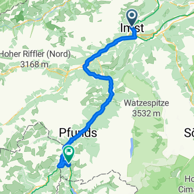
Via Claudia Augusta 4. Imst - Cusio
A cycling route starting in Imst, Tyrol, Austria.
Overview
About this route
From Imst, the route initially takes you leisurely along the Inn, with the Inttal motorway present everywhere. After a short rest in Landeck, it gently ascends until Pfunds, where the cycling path goes through small villages and barely trafficked forest roads. Behind Pfunds, the Kajetan Bridge marks the beginning of the Reschen federal road. It now steadily climbs, and there are 2 tunnels to pass through. After the fortress of Nauders, it is not too far to Nauders. Here, one should refuel, as there are about 150 meters of elevation left to the pass. Passing by Lake Reschen, the well-developed Etschtal cycling path leads over Burgeis to Schleis.
- -:--
- Duration
- 89.2 km
- Distance
- 2,037 m
- Ascent
- 1,916 m
- Descent
- ---
- Avg. speed
- ---
- Max. altitude

Continue with Bikemap
Use, edit, or download this cycling route
You would like to ride Via Claudia Augusta 4. Imst - Cusio or customize it for your own trip? Here is what you can do with this Bikemap route:
Free features
- Save this route as favorite or in collections
- Copy & plan your own version of this route
- Split it into stages to create a multi-day tour
- Sync your route with Garmin or Wahoo
Premium features
Free trial for 3 days, or one-time payment. More about Bikemap Premium.
- Navigate this route on iOS & Android
- Export a GPX / KML file of this route
- Create your custom printout (try it for free)
- Download this route for offline navigation
Discover more Premium features.
Get Bikemap PremiumFrom our community
Other popular routes starting in Imst
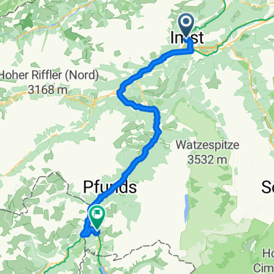
 Route nach Pfunds
- Distance
- 54.5 km
- Ascent
- 1,247 m
- Descent
- 1,095 m
- Location
- Imst, Tyrol, Austria
 Pfarrgasse, Imst nach Nauders, Nauders
- Distance
- 73.4 km
- Ascent
- 2,162 m
- Descent
- 1,622 m
- Location
- Imst, Tyrol, Austria
 2010 imst - weer 7.07.10
- Distance
- 89.2 km
- Ascent
- 128 m
- Descent
- 313 m
- Location
- Imst, Tyrol, Austria
 Mittenwald - Schönberg im Stubaital
- Distance
- 73.3 km
- Ascent
- 2,177 m
- Descent
- 1,608 m
- Location
- Imst, Tyrol, Austria
 CA4 Imst to Landeck-Zams (Austria)
- Distance
- 22 km
- Ascent
- 277 m
- Descent
- 360 m
- Location
- Imst, Tyrol, Austria
 Fabrikstraße 34, Gemeinde Imst do Kronburg 105, Zammerberg
- Distance
- 13.7 km
- Ascent
- 321 m
- Descent
- 110 m
- Location
- Imst, Tyrol, Austria
 2. Etappe 18.07.2021 Imst nach Pfunds
- Distance
- 55.4 km
- Ascent
- 420 m
- Descent
- 258 m
- Location
- Imst, Tyrol, Austria
 Via Claudia Augusta 4. Imst - Cusio
- Distance
- 89.2 km
- Ascent
- 2,037 m
- Descent
- 1,916 m
- Location
- Imst, Tyrol, Austria
Open it in the app