

Day2 OO
A cycling route starting in Lobethal, South Australia, Australia.
Overview
About this route
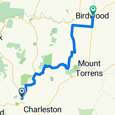
Lobethal to Tanunda - Chateau Tanunda Route shown is a general guide - accuracy cannot be guaranteed. Subject to change depending on trail and weather conditions. (cloned from route 886353)
- -:--
- Duration
- 74 km
- Distance
- 496 m
- Ascent
- 635 m
- Descent
- ---
- Avg. speed
- ---
- Max. altitude

Route quality
Waytypes & surfaces along the route
Waytypes
Quiet road
42.9 km
(58 %)
Track
14.8 km
(20 %)
Surfaces
Paved
19.2 km
(26 %)
Unpaved
43.7 km
(59 %)
Ground
22.9 km
(31 %)
Unpaved (undefined)
19.2 km
(26 %)
Continue with Bikemap
Use, edit, or download this cycling route
You would like to ride Day2 OO or customize it for your own trip? Here is what you can do with this Bikemap route:
Free features
- Save this route as favorite or in collections
- Copy & plan your own version of this route
- Sync your route with Garmin or Wahoo
Premium features
Free trial for 3 days, or one-time payment. More about Bikemap Premium.
- Navigate this route on iOS & Android
- Export a GPX / KML file of this route
- Create your custom printout (try it for free)
- Download this route for offline navigation
Discover more Premium features.
Get Bikemap PremiumFrom our community
Other popular routes starting in Lobethal
 TDA - Charleston Ride (Palmer
- Distance
- 66.6 km
- Ascent
- 690 m
- Descent
- 616 m
- Location
- Lobethal, South Australia, Australia
 Bike SA Outback Odyssey 2015 Day 2
- Distance
- 74 km
- Ascent
- 496 m
- Descent
- 635 m
- Location
- Lobethal, South Australia, Australia
 Adelaide
- Distance
- 45.1 km
- Ascent
- 342 m
- Descent
- 480 m
- Location
- Lobethal, South Australia, Australia
 Bike SA Outback Odyssey Day 2
- Distance
- 74 km
- Ascent
- 471 m
- Descent
- 610 m
- Location
- Lobethal, South Australia, Australia
 Lobethal Charleston , Mt Torrens All Sealed
- Distance
- 22.8 km
- Ascent
- 354 m
- Descent
- 354 m
- Location
- Lobethal, South Australia, Australia
 Mawson Trail Lobethal to Birdwood
- Distance
- 18.4 km
- Ascent
- 204 m
- Descent
- 230 m
- Location
- Lobethal, South Australia, Australia
 EgoTrip 2009 V2
- Distance
- 32.9 km
- Ascent
- 790 m
- Descent
- 790 m
- Location
- Lobethal, South Australia, Australia
 Charleston, Gladigau, Cyanide, Amy
- Distance
- 36.6 km
- Ascent
- 418 m
- Descent
- 416 m
- Location
- Lobethal, South Australia, Australia
Open it in the app