

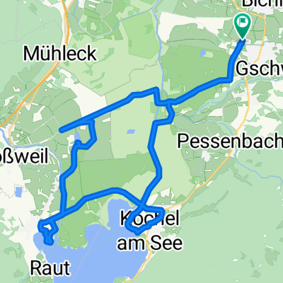
Rundweg Benediktbeuern - Tutzinger Hütte
A cycling route starting in Benediktbeuern, Bavaria, Germany.
Overview
About this route
x (cloned from route 3041374)
- -:--
- Duration
- 18 km
- Distance
- 635 m
- Ascent
- 635 m
- Descent
- ---
- Avg. speed
- ---
- Max. altitude
Route highlights
Points of interest along the route
Point of interest after 8 km
Tutzinger Hütte
Continue with Bikemap
Use, edit, or download this cycling route
You would like to ride Rundweg Benediktbeuern - Tutzinger Hütte or customize it for your own trip? Here is what you can do with this Bikemap route:
Free features
- Save this route as favorite or in collections
- Copy & plan your own version of this route
- Sync your route with Garmin or Wahoo
Premium features
Free trial for 3 days, or one-time payment. More about Bikemap Premium.
- Navigate this route on iOS & Android
- Export a GPX / KML file of this route
- Create your custom printout (try it for free)
- Download this route for offline navigation
Discover more Premium features.
Get Bikemap PremiumFrom our community
Other popular routes starting in Benediktbeuern
 Handbike-Tour Benediktbeuern - Kochelsee (barrierefrei)
- Distance
- 30 km
- Ascent
- 67 m
- Descent
- 65 m
- Location
- Benediktbeuern, Bavaria, Germany
 Benediktenwandrunde 60km
- Distance
- 59.3 km
- Ascent
- 1,730 m
- Descent
- 1,730 m
- Location
- Benediktbeuern, Bavaria, Germany
 Benedikbeuern von Kapelle zu Kapelle, Wanderung
- Distance
- 10.5 km
- Ascent
- 101 m
- Descent
- 101 m
- Location
- Benediktbeuern, Bavaria, Germany
 Prälatenstraße 19, Benediktbeuern nach Prälatenstraße 19, Benediktbeuern
- Distance
- 23.5 km
- Ascent
- 312 m
- Descent
- 317 m
- Location
- Benediktbeuern, Bavaria, Germany
 Benedikbeuern von Kapelle zu Kapelle, Radtour
- Distance
- 25.3 km
- Ascent
- 232 m
- Descent
- 232 m
- Location
- Benediktbeuern, Bavaria, Germany
 Alpen 22 1. Tag
- Distance
- 123.6 km
- Ascent
- 2,364 m
- Descent
- 1,990 m
- Location
- Benediktbeuern, Bavaria, Germany
 Kirchen und Kapellen des ehem. Benediktbeurer Klosterlands Süd
- Distance
- 33.4 km
- Ascent
- 182 m
- Descent
- 181 m
- Location
- Benediktbeuern, Bavaria, Germany
 20150912_Benediktbeuern-Seeshaupt-Wolfratshausen-BadToelz
- Distance
- 83.8 km
- Ascent
- 452 m
- Descent
- 452 m
- Location
- Benediktbeuern, Bavaria, Germany
Open it in the app