

2015 Ride Day 35 - Labastide d'Armagnac to Le Passage-d'Agen
A cycling route starting in Cazaubon, Occitanie, France.
Overview
About this route
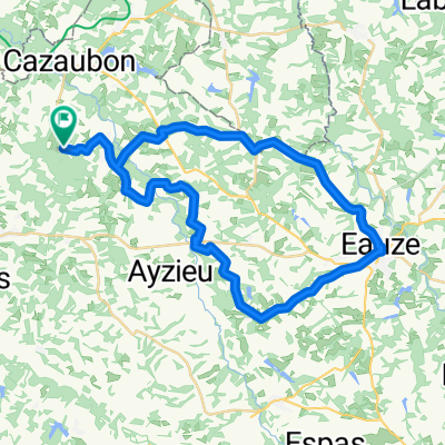
This was a great ride on mostly outstanding low-traffic roads. The exceptions were D930, though there was good shoulder, albeit pretty narrow, and D656 east of Nérac, where there was a bit too much traffic, but otherwise the road was good.
D7 was a very pretty road that had a killer hill, so to speak, starting from where it went east from D656. The road into Le Passage wasn't great, but it was better than expected with some bile lane.- -:--
- Duration
- 85.5 km
- Distance
- 507 m
- Ascent
- 532 m
- Descent
- ---
- Avg. speed
- ---
- Max. altitude

Route quality
Waytypes & surfaces along the route
Waytypes
Quiet road
17.1 km
(20 %)
Access road
2.6 km
(3 %)
Surfaces
Paved
35 km
(41 %)
Unpaved
1.7 km
(2 %)
Asphalt
34.2 km
(40 %)
Concrete
0.9 km
(1 %)
Continue with Bikemap
Use, edit, or download this cycling route
You would like to ride 2015 Ride Day 35 - Labastide d'Armagnac to Le Passage-d'Agen or customize it for your own trip? Here is what you can do with this Bikemap route:
Free features
- Save this route as favorite or in collections
- Copy & plan your own version of this route
- Split it into stages to create a multi-day tour
- Sync your route with Garmin or Wahoo
Premium features
Free trial for 3 days, or one-time payment. More about Bikemap Premium.
- Navigate this route on iOS & Android
- Export a GPX / KML file of this route
- Create your custom printout (try it for free)
- Download this route for offline navigation
Discover more Premium features.
Get Bikemap PremiumFrom our community
Other popular routes starting in Cazaubon
 J5 - Labastide / Mont de Marsan
- Distance
- 31.8 km
- Ascent
- 160 m
- Descent
- 200 m
- Location
- Cazaubon, Occitanie, France
 RANDONNEE ABC DE LAREE
- Distance
- 50 km
- Ascent
- 401 m
- Descent
- 433 m
- Location
- Cazaubon, Occitanie, France
 Lusolle: SOURCES DE MONCAUT
- Distance
- 83.6 km
- Ascent
- 217 m
- Descent
- 217 m
- Location
- Cazaubon, Occitanie, France
 Eug-laberdolive
- Distance
- 43.8 km
- Ascent
- 288 m
- Descent
- 320 m
- Location
- Cazaubon, Occitanie, France
 FIETSTOCHT LIAS PANJAS MONGUILHEM MAULEON MONCLAR
- Distance
- 33.9 km
- Ascent
- 312 m
- Descent
- 311 m
- Location
- Cazaubon, Occitanie, France
 2015 Ride Day 35 - Labastide d'Armagnac to Le Passage-d'Agen
- Distance
- 85.5 km
- Ascent
- 507 m
- Descent
- 532 m
- Location
- Cazaubon, Occitanie, France
 ´Jakobsweg 17. Etappe
- Distance
- 87.8 km
- Ascent
- 407 m
- Descent
- 451 m
- Location
- Cazaubon, Occitanie, France
 ESTOURES - EAUZE - SAUBOIRES - CAMPAGNE - CUTXAN - LAREE
- Distance
- 43.6 km
- Ascent
- 277 m
- Descent
- 274 m
- Location
- Cazaubon, Occitanie, France
Open it in the app