
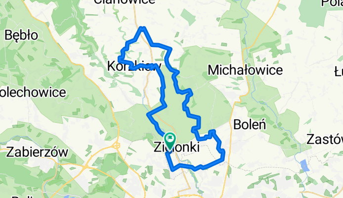
Zielonki (szlak okrężny)
A cycling route starting in Zielonki, Lesser Poland Voivodeship, Poland.
Overview
About this route
The trail leads through the most interesting corners of the Zielonki commune, allowing for the discovery of its landscape and cultural values. We will see, among others, the valleys of Bibiczanka, Garliczki, Korzkiewki, and Prądnik, the castle in Korzkwi, the manor complex in Owczary, and the post-Austrian fortifications in Zielonki and Bibice. The trail in its southern part can be classified as easy. It runs almost on flat terrain along the border of the Kraków-Częstochowa Upland and the Kraków Gate, within which Kraków is located. In the northern part, the route is characterized by significant altitude differences between the aforementioned valleys and the plateaus that stretch above them. Therefore, the trail in this section can be classified as difficult. When planning an excursion, we can also use other cycling and hiking trails that are also accessible for bicycles, freely modifying the route to shorten or lengthen it depending on our needs.
- -:--
- Duration
- 32.6 km
- Distance
- 363 m
- Ascent
- 365 m
- Descent
- ---
- Avg. speed
- ---
- Max. altitude
Route highlights
Points of interest along the route
\"")
Point of interest after 0 km
Hala sportowa w Zielonkach
\"")
Point of interest after 9 km
Hotel Twierdza
\"")
Point of interest after 9.3 km
Punkt spoczynkowy
\"")
Point of interest after 11.5 km
Zespół dworski w Garlicy Murowanej
\"")
Point of interest after 17.1 km
Zespół dworski w Owczarach
\"")
Point of interest after 23.7 km
Zamek w Korzkwi
\"")
Point of interest after 30.6 km
Teren sportowo-rekreacyjny
Point of interest after 31 km
Fort Pękowice
\"")
Point of interest after 32.6 km
Kościół w Zielonkach
Continue with Bikemap
Use, edit, or download this cycling route
You would like to ride Zielonki (szlak okrężny) or customize it for your own trip? Here is what you can do with this Bikemap route:
Free features
- Save this route as favorite or in collections
- Copy & plan your own version of this route
- Sync your route with Garmin or Wahoo
Premium features
Free trial for 3 days, or one-time payment. More about Bikemap Premium.
- Navigate this route on iOS & Android
- Export a GPX / KML file of this route
- Create your custom printout (try it for free)
- Download this route for offline navigation
Discover more Premium features.
Get Bikemap PremiumFrom our community
Other popular routes starting in Zielonki
 Treningo-wycieczka MTB na Pustynię Błędowską
- Distance
- 114.7 km
- Ascent
- 783 m
- Descent
- 783 m
- Location
- Zielonki, Lesser Poland Voivodeship, Poland
 pętelka treningowa
- Distance
- 47.6 km
- Ascent
- 634 m
- Descent
- 636 m
- Location
- Zielonki, Lesser Poland Voivodeship, Poland
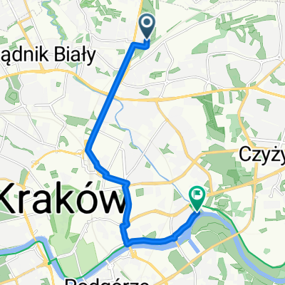 Route to Krakow
- Distance
- 8.9 km
- Ascent
- 8 m
- Descent
- 39 m
- Location
- Zielonki, Lesser Poland Voivodeship, Poland
 Szlak czerwony w gminie zielonki
- Distance
- 32.6 km
- Ascent
- 345 m
- Descent
- 345 m
- Location
- Zielonki, Lesser Poland Voivodeship, Poland
 Dolina Prądnika
- Distance
- 44.4 km
- Ascent
- 421 m
- Descent
- 421 m
- Location
- Zielonki, Lesser Poland Voivodeship, Poland
 Dolina Dłubni
- Distance
- 59.3 km
- Ascent
- 826 m
- Descent
- 830 m
- Location
- Zielonki, Lesser Poland Voivodeship, Poland
 Wola Zachariaszowska- Witkowice
- Distance
- 7 km
- Ascent
- 31 m
- Descent
- 107 m
- Location
- Zielonki, Lesser Poland Voivodeship, Poland
 Zimowo super zamrożone.
- Distance
- 54 km
- Ascent
- 489 m
- Descent
- 487 m
- Location
- Zielonki, Lesser Poland Voivodeship, Poland
Open it in the app