

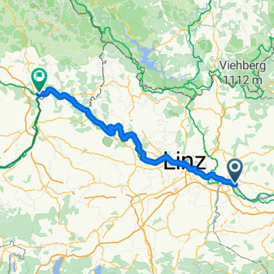
Perg - St.Thomas - Rechberg - PErg
A cycling route starting in Perg, Upper Austria, Austria.
Overview
About this route
Schöne Biketour durchs Mühlviertel! Von Asphalt bis Schotter alles dabei!
(cloned from route 1586355)
- -:--
- Duration
- 45.4 km
- Distance
- 878 m
- Ascent
- 878 m
- Descent
- ---
- Avg. speed
- ---
- Max. altitude
Route quality
Waytypes & surfaces along the route
Waytypes
Quiet road
22.9 km
(51 %)
Busy road
10.6 km
(23 %)
Surfaces
Paved
2.9 km
(6 %)
Unpaved
6.2 km
(14 %)
Asphalt
2.9 km
(6 %)
Ground
2.9 km
(6 %)
Continue with Bikemap
Use, edit, or download this cycling route
You would like to ride Perg - St.Thomas - Rechberg - PErg or customize it for your own trip? Here is what you can do with this Bikemap route:
Free features
- Save this route as favorite or in collections
- Copy & plan your own version of this route
- Sync your route with Garmin or Wahoo
Premium features
Free trial for 3 days, or one-time payment. More about Bikemap Premium.
- Navigate this route on iOS & Android
- Export a GPX / KML file of this route
- Create your custom printout (try it for free)
- Download this route for offline navigation
Discover more Premium features.
Get Bikemap PremiumFrom our community
Other popular routes starting in Perg
 Perg - St.Thomas - Rechberg - PErg
- Distance
- 45.4 km
- Ascent
- 878 m
- Descent
- 878 m
- Location
- Perg, Upper Austria, Austria
 Au - Pasau Donauradweg
- Distance
- 125.4 km
- Ascent
- 363 m
- Descent
- 297 m
- Location
- Perg, Upper Austria, Austria
 Schwammerlstein Runde
- Distance
- 14.1 km
- Ascent
- 418 m
- Descent
- 419 m
- Location
- Perg, Upper Austria, Austria
 Birkenweg 19, Tragwein nach Lärchenweg 28, Tragwein
- Distance
- 14.5 km
- Ascent
- 205 m
- Descent
- 207 m
- Location
- Perg, Upper Austria, Austria
 MTB Perg
- Distance
- 37.1 km
- Ascent
- 771 m
- Descent
- 771 m
- Location
- Perg, Upper Austria, Austria
 schwert-lina-windegg-schwert
- Distance
- 14.8 km
- Ascent
- 355 m
- Descent
- 357 m
- Location
- Perg, Upper Austria, Austria
 Flößerweg, Naarn im Machlande nach Kreuznerstraße, Grein
- Distance
- 32.2 km
- Ascent
- 239 m
- Descent
- 222 m
- Location
- Perg, Upper Austria, Austria
 Wien Passau-Etappe 3
- Distance
- 125.5 km
- Ascent
- 1,552 m
- Descent
- 1,486 m
- Location
- Perg, Upper Austria, Austria
Open it in the app