

hirschbergtrail-bad-wiessee
A cycling route starting in Bad Wiessee, Bavaria, Germany.
Overview
About this route
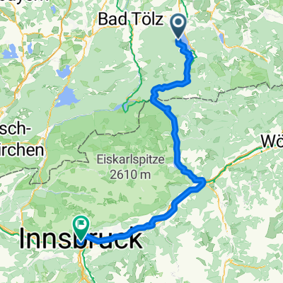
Bag Wiesse 25km 729hm
- -:--
- Duration
- 24.6 km
- Distance
- 684 m
- Ascent
- 683 m
- Descent
- ---
- Avg. speed
- ---
- Max. altitude
Continue with Bikemap
Use, edit, or download this cycling route
You would like to ride hirschbergtrail-bad-wiessee or customize it for your own trip? Here is what you can do with this Bikemap route:
Free features
- Save this route as favorite or in collections
- Copy & plan your own version of this route
- Sync your route with Garmin or Wahoo
Premium features
Free trial for 3 days, or one-time payment. More about Bikemap Premium.
- Navigate this route on iOS & Android
- Export a GPX / KML file of this route
- Create your custom printout (try it for free)
- Download this route for offline navigation
Discover more Premium features.
Get Bikemap PremiumFrom our community
Other popular routes starting in Bad Wiessee
 T20_Hirschberg
- Distance
- 40.1 km
- Ascent
- 1,160 m
- Descent
- 1,160 m
- Location
- Bad Wiessee, Bavaria, Germany
 Bad Wiessee - Lengries - Glashütte - Scharling
- Distance
- 52.7 km
- Ascent
- 1,346 m
- Descent
- 1,346 m
- Location
- Bad Wiessee, Bavaria, Germany
 20090726 Schinderrunde
- Distance
- 62.4 km
- Ascent
- 977 m
- Descent
- 989 m
- Location
- Bad Wiessee, Bavaria, Germany
 hirschbergtrail-bad-wiessee
- Distance
- 24.6 km
- Ascent
- 684 m
- Descent
- 683 m
- Location
- Bad Wiessee, Bavaria, Germany
 Lenggrieserhuette_Ringsee
- Distance
- 9.8 km
- Ascent
- 220 m
- Descent
- 707 m
- Location
- Bad Wiessee, Bavaria, Germany
 Bad Heilbrunn - Bad Wiessee + Von Bad Wiessee bis Vahrn
- Distance
- 101.7 km
- Ascent
- 1,551 m
- Descent
- 1,716 m
- Location
- Bad Wiessee, Bavaria, Germany
 Bauer in der Au/ Schwarze Tenn/ Sieben Hütten
- Distance
- 33.4 km
- Ascent
- 556 m
- Descent
- 556 m
- Location
- Bad Wiessee, Bavaria, Germany
 Transalp 2009
- Distance
- 415.3 km
- Ascent
- 7,144 m
- Descent
- 7,816 m
- Location
- Bad Wiessee, Bavaria, Germany
Open it in the app