

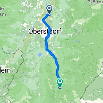
Emmaus-Biker TransAlp2015 1. Etappe: Oberstdorf - St. Anton
A cycling route starting in Oberstdorf, Bavaria, Germany.
Overview
About this route
Our first stage of TransAlp2015 from Oberstdorf to St. Anton. The weather was unfortunately not so good: cloudy but dry. The trail takes us from the hotel before Oberstdorf, through the village, and then the path past the old ski jump, climbing higher and higher. Initially over a fairly wide 'forest highway', then later over the usual hiking paths up to Schrofen Pass. Here we have to overcome some stairs and ladders before heading back down to the valley. Great but in some places challenging descent - in the fog sometimes quite tricky!!!
- -:--
- Duration
- 52.3 km
- Distance
- 1,525 m
- Ascent
- 1,044 m
- Descent
- ---
- Avg. speed
- ---
- Max. altitude

Continue with Bikemap
Use, edit, or download this cycling route
You would like to ride Emmaus-Biker TransAlp2015 1. Etappe: Oberstdorf - St. Anton or customize it for your own trip? Here is what you can do with this Bikemap route:
Free features
- Save this route as favorite or in collections
- Copy & plan your own version of this route
- Sync your route with Garmin or Wahoo
Premium features
Free trial for 3 days, or one-time payment. More about Bikemap Premium.
- Navigate this route on iOS & Android
- Export a GPX / KML file of this route
- Create your custom printout (try it for free)
- Download this route for offline navigation
Discover more Premium features.
Get Bikemap PremiumFrom our community
Other popular routes starting in Oberstdorf
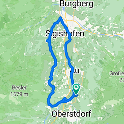
 Tiefenbach - Immenstadt - Oberstdorf - Tiefenbach
- Distance
- 60.6 km
- Ascent
- 345 m
- Descent
- 343 m
- Location
- Oberstdorf, Bavaria, Germany
 06x Oberstdorf Rundweg über Spielmannsau
- Distance
- 34.6 km
- Ascent
- 899 m
- Descent
- 898 m
- Location
- Oberstdorf, Bavaria, Germany
 Oberstdorf až Walserstraße, Mittelberg
- Distance
- 6.6 km
- Ascent
- 57 m
- Descent
- 240 m
- Location
- Oberstdorf, Bavaria, Germany
 Runde zum großen Alpsee
- Distance
- 86.1 km
- Ascent
- 795 m
- Descent
- 864 m
- Location
- Oberstdorf, Bavaria, Germany
 Rubi über Hörnerdörfer zurück
- Distance
- 31.1 km
- Ascent
- 532 m
- Descent
- 536 m
- Location
- Oberstdorf, Bavaria, Germany
 Alpencross 2010 | Etappe 1
- Distance
- 59.3 km
- Ascent
- 1,978 m
- Descent
- 2,017 m
- Location
- Oberstdorf, Bavaria, Germany
 Rubi nach Trettachtal
- Distance
- 13.6 km
- Ascent
- 386 m
- Descent
- 73 m
- Location
- Oberstdorf, Bavaria, Germany
 iller - Donautal 1.tag
- Distance
- 64.6 km
- Ascent
- 126 m
- Descent
- 224 m
- Location
- Oberstdorf, Bavaria, Germany
Open it in the app