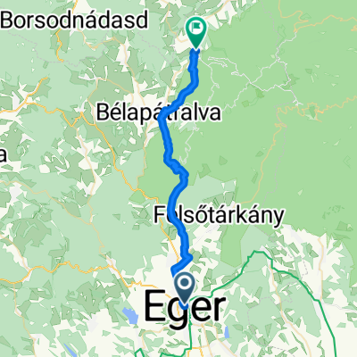
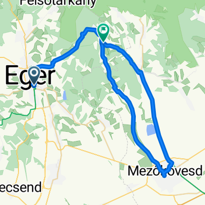
Eger-Szilvásvárad-Jávorkút
A cycling route starting in Eger, Heves County, Hungary.
Overview
About this route
Egerből egy darabig bicikliúton, majd a 25-ös úton Szilvásváradig. Szalajka völgy, fátyol vízesés, majd fel erdei úton Jávorkútig. Végig aszfalt, de változó minőségű.
- -:--
- Duration
- 54.8 km
- Distance
- 799 m
- Ascent
- 281 m
- Descent
- ---
- Avg. speed
- ---
- Max. altitude
Route highlights
Points of interest along the route
Photo after 31.9 km
Fátyolvízesés, Szalajka völgy
Continue with Bikemap
Use, edit, or download this cycling route
You would like to ride Eger-Szilvásvárad-Jávorkút or customize it for your own trip? Here is what you can do with this Bikemap route:
Free features
- Save this route as favorite or in collections
- Copy & plan your own version of this route
- Sync your route with Garmin or Wahoo
Premium features
Free trial for 3 days, or one-time payment. More about Bikemap Premium.
- Navigate this route on iOS & Android
- Export a GPX / KML file of this route
- Create your custom printout (try it for free)
- Download this route for offline navigation
Discover more Premium features.
Get Bikemap PremiumFrom our community
Other popular routes starting in Eger
- Egerbike - Várkút kör
- Distance
- 37.6 km
- Ascent
- 509 m
- Descent
- 511 m
- Location
- Eger, Heves County, Hungary
- Eger-Kékestető-Eger
- Distance
- 107.7 km
- Ascent
- 1,288 m
- Descent
- 1,289 m
- Location
- Eger, Heves County, Hungary
- Eger-Miskolc
- Distance
- 69.8 km
- Ascent
- 1,171 m
- Descent
- 1,211 m
- Location
- Eger, Heves County, Hungary
- ha kemények leszünk
- Distance
- 73.6 km
- Ascent
- 889 m
- Descent
- 889 m
- Location
- Eger, Heves County, Hungary
- Eger Kőporos - Novaj Felső Időfutampálya
- Distance
- 10.2 km
- Ascent
- 152 m
- Descent
- 139 m
- Location
- Eger, Heves County, Hungary
- Eger-Bükkszék-Sirok-Eger
- Distance
- 49.1 km
- Ascent
- 546 m
- Descent
- 551 m
- Location
- Eger, Heves County, Hungary
- ördögi kör
- Distance
- 46.2 km
- Ascent
- 442 m
- Descent
- 434 m
- Location
- Eger, Heves County, Hungary
- Körtúra Egerből Felsőtárkányba
- Distance
- 25.3 km
- Ascent
- 283 m
- Descent
- 283 m
- Location
- Eger, Heves County, Hungary
Open it in the app