Chau Doc to Ha Tein
A cycling route starting in Cho Dok, An Giang, Vietnam.
Overview
About this route
Quiet canal country road mostly sealed with worn ashphalt. Real VN coutry villages along tree lined roads flowing canals.
- -:--
- Duration
- 92.7 km
- Distance
- 20 m
- Ascent
- 25 m
- Descent
- ---
- Avg. speed
- ---
- Avg. speed
Continue with Bikemap
Use, edit, or download this cycling route
You would like to ride Chau Doc to Ha Tein or customize it for your own trip? Here is what you can do with this Bikemap route:
Free features
- Save this route as favorite or in collections
- Copy & plan your own version of this route
- Sync your route with Garmin or Wahoo
Premium features
Free trial for 3 days, or one-time payment. More about Bikemap Premium.
- Navigate this route on iOS & Android
- Export a GPX / KML file of this route
- Create your custom printout (try it for free)
- Download this route for offline navigation
Discover more Premium features.
Get Bikemap PremiumFrom our community
Other popular routes starting in Cho Dok
- Chau Doc-Cao Lanh
- Distance
- 84.9 km
- Ascent
- 41 m
- Descent
- 48 m
- Location
- Cho Dok, An Giang, Vietnam
- VN 5 Chau Doc to Long Xuyen
- Distance
- 54.7 km
- Ascent
- 24 m
- Descent
- 28 m
- Location
- Cho Dok, An Giang, Vietnam
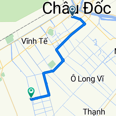
- 97 Nguyen Huu Canh, Chau Doc to 78 Nguyen Huu Canh, Chau Doc
- Distance
- 6.1 km
- Ascent
- 10 m
- Descent
- 6 m
- Location
- Cho Dok, An Giang, Vietnam
- Chau Doc to Ha Tein
- Distance
- 92.7 km
- Ascent
- 20 m
- Descent
- 25 m
- Location
- Cho Dok, An Giang, Vietnam
- 8^ tappa Long Xuyen
- Distance
- 65.2 km
- Ascent
- 41 m
- Descent
- 42 m
- Location
- Cho Dok, An Giang, Vietnam
- Chao Doc - HCM
- Distance
- 276.4 km
- Ascent
- 40 m
- Descent
- 34 m
- Location
- Cho Dok, An Giang, Vietnam
- 133 Street 30 Thang 4, Chau Doc to 78 Nguyen Huu Canh, Chau Doc
- Distance
- 17.1 km
- Ascent
- 20 m
- Descent
- 15 m
- Location
- Cho Dok, An Giang, Vietnam
Open it in the app